Saturday, May 24, 2014

Fellbarrow from Cockermouth

pretty happy to be on Fellbarrow

Something different today.  I met up with Jonathan and Stephen at the usual parking spot in Cockermouth and told them I would drive.  Jonathan asked if we could go to the garage for drinks, so we did.  I then drove back to the usual parking spot, parked up, switched my Garmin watch on and said, "are you ready then?"

It's fair to say that it freaked Jonathan out a bit.  You see, after my map mishap on Binsey yesterday where I mistook a track for a public footpath, ending up in us running through a private garden, I went home and studied the map.  I saw that there were public footpaths everywhere and came up with the idea of a trail run from our usual parking spot.  The trail run ended up going along the track that goes near to Fellbarrow so I thought, even better, get a Wainwright in.

OS 25k of the route.  It was about 12.8 miles when we got back to the car but we 
did a few laps to make it up to a half marathon distance.

18th Century Stanger Spa
The route started by heading down by the river and following it south along the east side.  There is a really nice trail that goes along the river.  After about three miles, we passed Stanger Spa, an old Saline well with waters which were thought to have health benefits.  After another mile, we were on the road at Lorton.  We turned right at Lorton Hall, taking the road onto the fell.  We turned off after a mile on the track that heads up towards Hatteringill, deviating from the track to take in Hatteringill Head and then on to Fellbarrow.  From the summit, we headed north, back to the track before taking a footpath off north towards Wood Farm where we picked up a road to Hill Farm, turning off on a track towards Low Hall.  Once through here, we turned west on the road, before following a footpath sign, dodging a herd of cows which got up and looked as if they were going to round Jonathan up, on through Waterloo Farm, coming out just near the Sheep and Wool Centre.  It was a short run back to the car where we did a few extra laps to make up the distance to 13.1 miles.

old Iron Legs leads the way up the track towards Fellbarrow

Grasmoor in the background, scene of Jonathan's recent nightmare

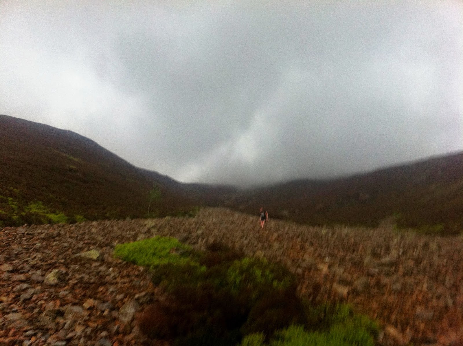
Hatteringill Head.  Fellbarrow can just be seen on the horizon.

He needed a bit of persuasion to have a "quick nip up and down Fellbarrow" but he was pleased to make it

I was pretty happy too

coming through Low Hall

50k map

Friday, May 23, 2014

Binsey

top of Binsey looking towards the back of Skiddaw fells

this is how Jonathan looks after running up Binsey
After our nice up and down route the other day, I picked out a nice five mile circular route.  It turns out that the last mile or so of it was through private land, something that the nice man at Binsey Cottage informed us of as we ran through his garden.  He really was nice about it and we had a little chat, we apologised and left on good terms.  I checked the map when I got home and he was right.  During the course of my day at work, I had converted the track that is shown on the OS 25k Map into a nice green footpath.  Ah well, the route could be adapted to come along the road at the end.

From the usual spot next to Binsey Cottage, we went up and over the summit, carrying on over to Whittas Park (which I note is also private land) before picking up the footpath which goes to High Ireby.  From here, we followed a track onto the open farmland, picking up the woodland track which brought us out at Binsey Cottage.  It really was a nice run, the whole of which is quite runnable.  It would obviously need an adjustment to avoid the private track and the easiest option would be to carry on along the road at High Ireby, turning right to Ruthwaite and then right again.


Tuesday, May 20, 2014

Whiteless Pike, Wandope and Grasmoor exit via Red Gill Scree

from Whiteless Pike summit looking up the path to Thirdgill Head and Wandope.

Yesterday we dodged the thunderstorm, today...not so much.  Although we set off in bright sunshine, it was evident as we climbed up Whiteless Breast that it was probably going to tip it down.  We parked at Cinderdale Common and headed up the Rannerdale valley.  The bluebells are already starting to fade away but still look beautiful.  Jonathan was experiencing a lull in energy so we took the climb up to Whiteless Pike very easy.  From there we ran across and picked up Wandope.  At this point the clouds were rolling in, there was a chill in the air and thunder could be heard in the distance.  I suggested to Jonathan that we didn't hang around too long and ran across to pick up the climb to Grasmoor.  We made our way over to the shelter on the summit and carried on to the third cairn where the entry into the scree descent of Red Gill begins.  At this point it was pouring rain, thundering and lightening.  We took our time down the scree (Jonathan said he hated every step) and eventually got to our cars.

about six miles

Bluebells on Rannerdale Knotts

climbing Whiteless Breast, looking back over Rannerdale Knotts

the biggest climb of the day ahead up Whiteless Pike

Jonathan low on energy climbing Whiteless Breast.  Buttermere Moss behind with the Newlands Pass visible on the left.
 
Whiteless Pike summit - I'm not sure what I am doing

there is a nice run along from Whiteless Pike until the path starts to climb again up to Thirdgill Head

at Wandope summit looking over to Grasmoor.  Our path up can be seen clearly

running along the flatter part of Grasmoor to the summit.  A real sense of urgency due to the weather

the summit.  Look at those clouds

straight down from here.  Crummock Water below

as soon as we got to the start of the descent, the cloud rolled in and it poured with rain.  I was taking photos on my phone so it was put away for the worst of the rain to stop it getting wet and broken.  Here is a blurry (due to low light) picture of Jonathan coming down the scree.  Grasmoor is in thick cloud.

further down, it briefly cleared up before pouring down again as we descended further

the first part of the run up the valley, onto Whiteless Breast and then steeply up to Whiteless Pike and on to Wandope.  Grasmoor is behind, you can just see the descent down Red Gill.

from Wandope, a nice grassy run over to the start of the climb to Grasmoor.  A steep initial climb up Grasmoor which flattens out to a very rounded summit.

and here is the descent - directly back to the car park.


Monday, May 19, 2014

Binsey

top of Binsey

"COME ON SATELLITES!"
Binsey is a small northern fell that doesn't fit neatly into any fell running rounds.  We recently went to see a presentation by Steve Birkenshaw who is attempting to beat Joss Naylor's record of completing the Wainwrights.  It's small, out of the way fells like Binsey and Castle Crag that cause problems.  Have a look at that link, it's a very serious undertaking.

Today though the plan was to just run straight up and down.  We parked at Binsey Cottage and really paced ourselves well on the long gradual pull up.  I was pleased to add Binsey to the short list of fells that I can actually run all the way from the bottom to the top of.

Once at the top, we dorked around for a while (mostly Jonathan) then turned around and enjoyed a speedy descent back to the car.

As we drove away, thunder clapped and lightening struck and then the heavens opened.  Running up a fell slowly, running back down faster and dodging a rather large thunder storm = success all around.


straight up and down - 1.4 miles, a bit more exploring needed around here


Sunday, May 18, 2014

Hart Crag, Stybarrow Dodd, Watson's Dodd, Great Dodd

from Birkett Fell on Hart Side.  Once at this point, the climbs are easier and the tracks good.  Birkett Fell is named after Lord Birkett of Ulverston who defeated a plan to convert Ullswater into a reservoir.  

8 and a bit miles - great route

Jonathan has been itching to run the dodds.  We started off with a plan for a linear run and two cars but decided to give this route a while.  It's a variation of a route I did a month ago.  That route was about 11 miles but today I decided to try the track off Great Dodd back to Cockley Moor, which shortened the route to about 8 miles.


We parked at Cockley Moor and ran the mile or so down the road to Dowthwaitehead.  From here we got onto the path that goes to Glencoyne but headed off right to keep climbing.  Birkett Fell is just over the higher wall and marks the point where the tough climbing is done.  We ran over to Hart Side and from here, the route options were clear.  Raise to the left looked formidable and the wind was blowing in the other direction so we made a choice to head up right to Stybarrow Dodd's flat summit.  From here, we followed a familiar route over to Watson's Dodd.  We chatted for a while to a runner who was out recceing to support a friend on the Bob Graham Round and then ran up to Great Dodd.  I was pleased to be able to run up from Watson's Dodd to Great Dodd.  In fact, I think I am gradually getting some fitness back.  From Great Dodd we took a nice track across Matterdale Common which went gradually down to the car park.  I'm sure that this area is usually very boggy but we got away with just a few muddy dips today.

Jonathan climbing up towards Birkett Fell with Dowthwaite Crag behind and Cockley Moor in the trees behind.

Birkett Fell with Hart Side behind on the right

Hart Side summit area.  Sheffield Pike on the left with the top of Glencoyne Head on the right over the steep cliffs.  I think St Sunday Crag is the next level back with Catstye Cam and Helvellyn just making the top right of the picture.

we took the track that runs along the north of White Stones from Hart Side.  This is looking over, before we began the last climb up to Stybarrow Dodd, to the ski tow and huts on Raise on the left with the enticing path up Raise on the right.

Stybarrow Dodd summit looking over to Watson's Dodd and then Blencathra behind with Skiddaw group to the left.

Jonathan pondering on Watson's Dodd with Great Dodd behind him.

running down from Great Dodd across Matterdale Common.


Sale Fell

Dorking

An easy evening run on our local fell.  Sale Fell is a good test of fitness.  Jonathan and I used to be able to run up and over it without stopping.  Today, there were plenty of stops including posing for photos for the Summit Dorks Facebook Group (you should join it).

We were also trying out the running poles that I won from sending a photo from this run into Trail Running Magazine.  Mountain King Trail Blaze poles.  Our verdict: it takes a bit of getting used to but they definitely help getting up steep hills.  I found that as the angle of ascent lessened, I couldn't move my arms as fast as my feet.  They fold up really nice and small and are as light as anything so would definitely be useful to have in your bag on longer runs.  I think they would be good for a big long climb like the nose of Kirk Fell.

3.5 miles

Jonathan - post asthma attack

errrr...


Wednesday, May 14, 2014

Loughrigg Fell

Loughrigg trig column looking over Lake Windermere

Jonathan and I had been working in Lancaster today so decided to pick out a run on the way back.  We're both coming back from illness & injury so we wanted something gentle.  Loughrigg Fell is ideal for this.  Some easy route finding with a lot of easy descending after the initial climb up.

as we start to climb up from White Moss Wood, looking over Grasmere

this is the way we want to come back

Grasmere again with Steel Fell behind Helm Crag and Seat Sandal on the right hand side

great views from here

lots of little tarns on the top

back on the terrace path

caves

the Rydal Cave (the one you're not supposed to go into)


back to the start