Friday, March 29, 2013

Howgills 26.2 recce run

The Montane Ultra 26.2 is a series of races in the North of England, all marathon distance on trails.  I was originally entered into the Grizedale 26.2 and enjoyed a recce run until I started to feel pain in my knee.  The pain didn't go away so I transferred to the Rivington 26.2.  Again, I enjoyed a recce run.  This time my knee held up well but the race was cancelled due to snow and severe wind.  So we have the option of entering the reorganised race later in the year or transferring to another event.  The next event is the Howgill 26.2 at the end of May.  We had a recce run of part of the course today.

the first part of the course is all climbing.  Here we are on Winder.  The track on the far right is where we are heading.

elevation profile - 5 miles of climbing did us in.

our route - the start and finish of the Howgills 26.2

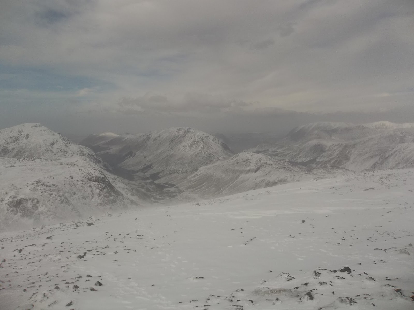
on Winder Fell, surrounded by familiar places
The terrain to begin with was wide grassy paths.  This gave way to gravel paths, some of them quite difficult to run on due to the size of the stones.  Some were made more difficult because they were packed with snow (well it is Good Friday!).  We cut off a corner of the official course and headed more directly towards Winder.  A kind gent took a picture on top and then we headed over towards Arrant Haw, the path dropping down initially before climbing again and flanking the top.  Further up the path was packed with snow which made progress slower.

Jonathan with Winder behind him

track around Arant Haw
On the other side of Arant Haw, there was a lot more snow left.  Again, we had a short downhill before a further climb up Brant Fell, turning sharply along the fence up to Calders and then over to Bram Rigg Top.

We continued over and up to the highest point today, The Calf (676m) before deviating from the course to run across to the east and rejoin the course of the Howgills 26.2 at Low Haygarth to complete the last section.

Coming over Hare Shaw, there was a lot of snow and we had a little play around jumping into it, making snow angels etc. until I realised that this path was so much fun that we had carried on following it for too long,  We climbed back over to the high point to descent along side Cautley Spout.  We picked out a path to the left of the river and followed it along, looking back at the partially frozen Cautley Spout, the highest waterfall above ground in England.
  
Jonathan heading down from Arant Haw

I think this is Bram Rigg Top


The Calf trig point


From The Calf, we headed east, descending fast.  As mentioned above, we got a bit carried away on a fun path, running through the snow and we had to double back to find the drop off point to head down towards the bottom of Cautley Spout.

The snow and climbing had really wore us out.  By the time we got back on the race route, Jonathan had cramp and my knee was aching.

We carried on along the route but then decided to cross the river and join up with the road which would take us back to Sedbergh.  We ran the last few miles on the road.  Getting back with a total of about 11.5 miles run.


Cautley Crag

top of Cautley Spout

further down

As we got back into Sedbergh, I asked Jonathan if he fancied a curry.  He didn't take much persuading but I think he was a bit put out when I got my Jetboil camp stove out and warmed up a boil in the bag curry sachet.  I thought it would be good practice for the GL3d.  While Jonathan was changed and sat in the front of my car, probably cursing me, I was setting my camp stove up at the side of my car.  The actual curry was very nice.  I think I will need about 50 of them for the event!


Overall, although we really enjoyed going somewhere different and finding our way around, we agreed that the climbing at the start did us in.  I think we are going to enter the reorganised Rivington race.  It was also a windy day which made it harder but, after last week's adventure on Great Gable, we have a different understanding of windy.

The Howgills are lovely, the thing is, at least in my opinion, they are not as lovely as the Lake District.


Wednesday, March 27, 2013

Great Gable Fell Run

Paul and Jonathan taking the fast way down from Great Gable

Rivington Ultra 26.2 was postponed due to snow and high winds.  We had a suspicion that this might be the case and thought about heading to Grizedale Forest for the Great Grizedale Trail Run but decided that the roads might be a bit dicey.  After a few mopey posts on Facebook, we had the offer of joining up with Lee and Paul for a run.  Jonathan wasn't keen but I managed to persuade him and so we headed off to Seathwaite, parking a bit short at Stonethwaite due to a snowy road.

The plan was something along the lines of the Four Lakeland Passes route that I had run in October.  I thought that this would be ideal as it would keep us off the tops and the navigation would be fairly easy.  It was evident from the initial climb up to Styhead Tarn that this route was a bit ambitious in the snow and very cold wind.  We decided to head over Great Gable and then make our way around the top end of Ennerdale, across to the Honister Slate Mine and back down the road to the car.

Here's the route:


Jonathan had never seen snow before

heading up to Sty Head, looking back down to Borrowdale

wind starting to get up

looking towards Seathwiate Fell

As we climbed up from Stockley Bridge, the normally busy path was empty.  The wind started to get up and the snow was pretty deep.  It was clear at this early stage that our plans had been ambitious and we decided to head over the top of Great Gable.

Lee at Styhead Tarn

Paul and Jonathan catching up

at the stretcher box towards Great End

The climb up Great Gable via the Breast Route was very difficult.  The winds were very high and at points we were hanging onto rocks to prevent being blown over.  Jonathan had his hat blown off and had to improvise with a buff.  He said that his fingers were also getting cold.  We were a bit worried about him and stopped in a sheltered spot to check he was ok.  He said that he was and that he had a jacket in his bag.  After fumbling in the wind, being sure not to let go of anything, we got his jacket out, it was a wafer thin Salomon running jacket, another layer but not really a great deal of help.

We thought about turning back but everyone said they were ok and there wasn't an easy way back so we carried on up to the top.  It was really nice when the gradient levelled out and, wind assisted now, we ran up to the top of Great Gable.

Paul and Jonathan as the climbing gets easier on Great Gable

A very cold Lee sheltering behind Great Gable summit.  Yewbarrow and Seatallan visible on the right.  You can just make out the screes rolling into Wast Water in the middle of the picture.

further around from the left, Pillar over Kirk Fell, the encroaching carpet of Ennerdale and then the High Stile range with Haystacks sitting modestly in the middle.  Further to the right, the highest fell is Grasmoor, then in front of it is Whiteless Pike and High Snockrigg leading up to Robinson.

We sat for a short while at the top of Great Gable.  Lee headed for what I think was the direct route to Kirk Fell, we decided that it was a bit steep going that way and headed off further around, down the corner of the fell, to the West side of Gable Crag.  There was deep snow here and the descent was fast and easy.  The snow never got much deeper than knee depth and we were soon where we wanted to be.

Paul and Jonathan 'styling it out' heading down from Great Gable summit

looking over to Kirk Fell, Beckhead Tarn at the bottom.

descent getting a bit steeper here.  I think this is Paul.

At the path junction, we joined the Moses Trod path which curves around the top of the valley behind Green Gable.  The path seems to follow the contours so it made for a nice little run.  We hopped the fence, an easy task as the snow was half way up it, and then ran across to the old mine track at Honister.  We followed the track down to the slate mine.  Toilet stop and spikes off then we carried on along the road back to Seatoller.

waiting for Jonathan at the path junction.

Lee gaining ground on Moses Trod


looking back to Great Gable, our route was down the right hand side.

looking down to Buttermere, Melbreak visible in the distance.

just before joining the old rail track, looking back with Paul and Jonathan catching up

down to Honister Slate Mine

Jonathan on a last bit of snow

top of Honister Pass

the gang

Honister Pass

back down at the cars - Beautiful Borrowdale

After a quick change, we had a pint and some chips (£10 minimum spend on cards) in front of a roaring fire at The Scafell Hotel.  Lots of laughs about Jonathan's near hypothermia and a promise to do more runs together soon (although I wasn't convinced that Jonathan was fully committed).


Wednesday, March 20, 2013

Embleton Church Race Course

The Embleton Church race was last weekend.  Jonathan ran it and said that it would be a great course to do after work.  So that's what we did last night.

Embleton Church - NY163 294
The course starts from the church, following the farm track across the road opposite to the church. Just after the start, the course starts to climb and keeps on climbing to the junction at Highside Farm.  The windy road along to the area marked Jenkin is up and down before a long descent, with one or two smaller hills thrown in, back to Hundith Hill Road.  After turning right, it is about a mile back to the church.  This section of the road is a mix of up and down but nothing too difficult.  The killer hills are at the start.

Our training has changed over the last few days, Jonathan has, wisely, decided not to do the GL3D and is going to train for a road marathon after Rivington this weekend.  That means he is tapering.  I am still doing the GL3D and want to try to use a run on Saturday and then Rivington the next day as a practice for long back to back runs.  This means that I still want to keep a fair amount of intensity to my running.  I ran this course at a tempo level, not all out but getting there.  I could definitely have gone a lot faster on the downhill sections.  Jonathan was right though, this is a great after work loop.

course

activity on Strava

Saturday, March 16, 2013

Fixing Glencoyne

Heading up to Nick Head with Glencoyne Head in front

Taper madness has set in!  No massive runs because I'm doing a marathon next weekend.  A nice easy fixing of fells will be an ideal activity.  Today I met up at Ullswater with Stephen, Anna, Paul and Christine for a relatively leisurely stroll with a spade.

Here is where we went:


There was a lot more snow left than anybody had been expecting.  It got quite difficult towards the top of the valley and this was partly the reason we decided on an alternative route back down.  The work was fairly easy, a lot of drains were covered in snow.  The walk around was a nice route and it's all good reconnaissance for the GL3D which starts nearby and may well travel along these valleys.

Glencoyne Valley

looking back over beautiful Ullswater

As usual, the company was very pleasant.  It was great to just get out fixing.  I've been focussing a bit on running lately and, what with becoming a father again and all, I'm afraid fixing the fells has been neglected a bit.  

Conversation ranged from the rules of rugby, literature, computers as well as some bad jokes.  Stephen is very knowledgeable about fell running so it was great to chat with him.

looking down to Greenside