|
| heading down off Sail and that path |
I have entered The Lake District Mountain Trail. It's in a few weeks time and it looks like a fun event. There are three levels, Classic (approx 16 miles with 7000ft climbing), Medium (approx 12 miles with 5000ft of climbing) and Short (approx 10 miles with 3500ft of climbing). The venue is announced a few weeks before the event (it hasn't been announced at the time of writing). Shortly after you set off you are given a map which is marked with the checkpoints. You then work out your own way between them. It's good old fashioned navigation, no GPS allowed.
The website has a cool Routegadget feature that allows you to see past courses plus the routes taken by the entrants. I used this to check out last year's short course:
So I had a bit of time this morning and thought I would give it a go. I ended up getting to the first two check points (marked by a triangle on the map below) and then I ran out of time so headed up to Sail to come back via Causey Pike.
 |
| over the beck up towards Causey Pike |
 |
| looking back over Derwent Water from the climb up Barrow |
I had my GPS in my bag in case of emergency. You are allowed to do this in the event but if you do use it, you are obviously supposed to declare yourself out of the event.
My route to the first checkpoint could have been better. There are a few things I should make clear, first, those helpful dotted lines on the maps are not there on the ground! Second, I was using a Harvey 1:40 map which is the same as those used for the competition. The maps on the left are OS 1:25 maps which are much more detailed.

You can see that my track snakes up the side of the fell. I set off up the fell far too early and found myself in deep bracken. If I had carried on, there is a path I could have taken to the Barrow Door junction. This would be an easy place to spot on the ground due not only to the crossroads of paths but the fact that it is a col.
I am hoping in the event, the checkpoints are brightly marked, perhaps even with a marshal at each one to help you get there. My onwards route was a bit better. I flanked Outerside. I got onto the main path at one point but this is a horribly rocky path so I got back off at the earliest opportunity. I then contoured around using various crags and sheepfolds to check my height. I was heading towards a beck, the checkpoint being just the other side of it. I saw the path up to Coledale Hause. This is a very distinct path so it is useful to anchor all the other points on the map from there. I hit the checkpoint straight on and was happy with this.
 |
| path up to Coledale Hause with Eel Crag on the left |
The onward route would have been probably to take this path and then head over towards checkpoint three but I was running out of time so I decided to head up towards Sail and follow the delightful ridge route along to Causey Pike.
 |
| from Sail looking up towards Eel Crag/Crag Hill |
 |
| and in the other direction - one of my favourite routes |
 |
| The infamous Sail path. I don't think anybody likes it but nobody can think of a better way of doing it. The path, which extends up Scar Crags, is actually nice to go up. I have to admit I took the track to the side on the downhill though - hopefully I don't get kicked out of Fix the Fells. |
 |
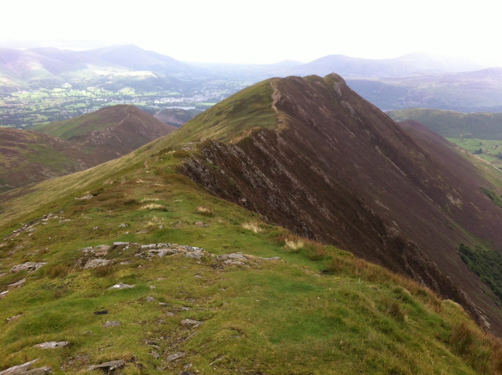
| from Scar Crags over to Causey Pike |
 |
| distinctive and beautiful. The heather on the right hand side had a wonderful purple tint (this is the same heather they are trying to protect with the path on Sail). |
 |
| there is a steep descent from Causey Pike. I branched off left to head towards my car but this is the view looking back up. |
 |
| and forward, heading back to the valley |
 |
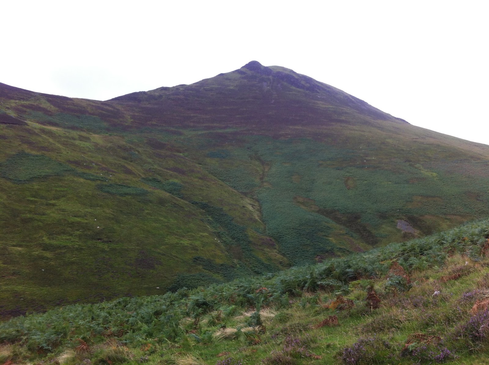
| I did have a bit of time after I finished so I popped into Keswick. It was very busy today so I didn't hang around for long but I did have to stop to take this picture. Can you see the distinct profile of Causey Pike? I've just ran across that. |


 You can see that my track snakes up the side of the fell. I set off up the fell far too early and found myself in deep bracken. If I had carried on, there is a path I could have taken to the Barrow Door junction. This would be an easy place to spot on the ground due not only to the crossroads of paths but the fact that it is a col.