|
| Paul, after taking a short cut to Great Rigg on day one |
The 2013 Great Lakeland 3 Day (GL3D) has been an event I have been looking forward to, with some trepidation, since marshalling at the 2012 event. This was a big deal for me, I had done a lot of preparation, practicing navigation, testing out my tent, checking I could fit all my kit into the 59L drybag allowance and of course, getting lots of running in.
 |
Looking across to Sheffield Pike, just the Glencoyne Valley
in the way.
|
My plan was to go to the event centre, at Dowthwaite Head Farm, the night before to pick up the map and then to come home and plan my routes. When I got there I was told that the maps had gone to Ennerdale in the back of somebody's van. A slight set back.
I phoned Paul, someone I had been running with before who was also entering the event. We agreed to run together and he kindly offered to give me a lift. Paul was planning on entering the Elite course, I was planning on entering the B course. When we got the map and had a look at the proposed courses, we decided on the A course (middle distance).
Day One:
From Dowthwaite Head, up and around Glencoyne Valley, down to Greenside Mine, steep climb up to Birkhouse Moor, over Striding Edge to Helvellyn, along to Grisedale Tarn then scoot around Fairfield to Great Rigg, along the ridge to Nab Scar, down to go around the back of Rydal and Grasmere Lakes, up Helm Crag, along over Gibson Knott and Calf Crag, picking up the Cumbria Way up to Greenop Edge, down Greenup Gill to Stonethwaite, onto the road up to Seatoller and then down the track to Seathwaite Farm.
 |
| Day One - 28 miles |
 |
| Striding Edge covered in mist |
Once we had worked out how to get out of the campsite (we were considering running along the road to Glenridding for a while) we found our way pretty well up to Helvellyn. Crossing Striding Edge in the mist was an interesting experience, possibly less scary than usual because we could not see the big drops on either side. From Helvellyn we turned off too early to contour around Dollywagon Pike. It actually wasn't a bad route option as it missed out the steep descent to Grisedale Tarn but it was completely accidental. We worked out that we didn't need to go to the top of Fairfield to reach the checkpoint on Great Rigg and so took another contour below the summit. On the flat section of Rydal and Grasmere, my stomach started to bother me and I feel like I owe the toilet cleaner at Grasmere Garden Centre an apology. All cleared up, we climbed up Helm Crag. This was a low point for me, completely lacking in energy. Looking back, I was pretty dehydrated at this point. I climbed slowly, one foot in front of the other and eventually got some energy back as we headed along the ridge to pick up the Cumbria Way path. I slipped on the wet rocks coming down Lining Crag and grazed my knuckles. The thin blood and increased circulation from running was certainly pumping it out so, when we got to a stream, I stopped to put plasters over my knuckles. We were both very tired and we walked most of the last section from the road along the track to Seathwaite Farm, just picking up a run as we entered the field.
 |
| the bad step down near the end of Striding Edge |
 |
| Paul at the checkpoint on Helvellyn |
 |
| Heading towards Dollywagon Pike before turning off too soon |
 |
| Grisedale Tarn |
 |
| looking down onto the next checkpoint on the other side of Rydal Water |
 |
| Helm Crag summit - no we didn't climb it |
 |
| heading over the Cumbria Way to Borrowdale |
 |
| Eagle Crag from Stonethwaite - flatish ground now! |
 |
| back at the Seathwaite Farm campsite |
After we checked in, we moved quickly to get our tents up in the relatively dry weather. I cooked some food and had a recovery drink, sorted my gear our and settled down for the night. I spent much of the evening filing down rough bits on my feet, stretching my legs out and massaging and kneading my leg muscles. My tent is too small to sit up straight in so it made for some interesting contortions.
Normally, after a long run, my legs twitch at night, making it difficult to get to sleep (it drives my wife mad) but I slept really well on the first night. Earplugs are an essential camping item. There were people in a tent next to me playing annoying music late into the night. How many times can you play a song before it isn't All Right Now?
Paul said that he had a rotten nights sleep. No earplugs I guess. On checking the results after the event, I saw that we were in 4th and 5th place after day one. This is effectively equal 4th as we were running together and the difference is the few seconds it takes to click into the checkpoints. There were 15 competitors in the A group and 11 out of the 15 did the whole course (didn't miss any checkpoints).
 |
| my tiny tent |
Day Two:
After stomach issues on day one, I was up early to make sure to 'use' the toilet before setting off. There was a queue for the one cubicle and, like the others in the queue, I resigned myself to the fact that others would hear me use the toilet. I think I performed quite well under pressure. Well enough that I didn't have any troubles of that sort on day two.
 |
| Day Two - 30.2 miles |
From Seathwaite Farm we climbed up Sourmilk Gill, along the Gillercomb Valley and up to Green Gable in the mist. From here we skirted around Great Gable and Kirk Fell to Pillar where we picked up the climbers' track to Robinson Cairn. We descended directly into Ennerdale Valley and then, after deciding to miss out High Stile and Red Pike due to very thick cloud and timing restrictions, we headed up and over Scarth Gap Pass into Buttermere. We ran along the lakeshore to Crummock Water and then ascended steeply up to Melbreak. Dropping back down into Loweswater, we ran around the top of Crummock Water to follow the rough track up to Coledale Hause, taking the mine road to Braithwaite. We followed roads around to Derwent Water where we ran along the shore and through the wood up to the campsite at Ashness.
 |
| looking down on the campsite from the climb and scramble up Sourmilk Gill |
 |
| wet conditions |
 |
| ghostly figures following us at the top of the Gillercomb Valley |
 |
| Green Gable check point |
 |
| Robinson Cairn on Pillar |
 |
| down to Ennerdale |
 |
| Scarth Gap Pass (I don't think they realise that this is the ridable section) |
 |
| Looking towards a cloudy Melbreak |
We made a navigation error on the approach to Pillar, dropping down too far into Ash Craggs, adding about 1k to the distance and meaning that we had a significant climb back up.
The run down the rocky front of Pillar to the Ennerdale Valley was really unpleasant, very slippery and wet then heading through a bit of forest. We made a decision at the bottom of the valley to take the wet weather course which meant missing out High Crag and Red Pike, a big ridge between Ennerdale and Buttermere. We made this decision due to time restrictions, the course guidance said that you should reach Melbreak by 1pm and we were not going to make it. These fells were also in heavy cloud, not fun to navigate in given the craggy nature of the ridge. At the time, I was disappointed but, when we got to Melbreak I was pleased not to have this additional climb and descent in my legs.
It was a slog up Melbreak. We chose the steep route. The top was covered in cloud and we ran through brambles until we eventually found the north top and check point. We were here at 2pm but were confident that we could make up time on the rest of the course.
 |
| finally we found that windy path down Coledale Hause |
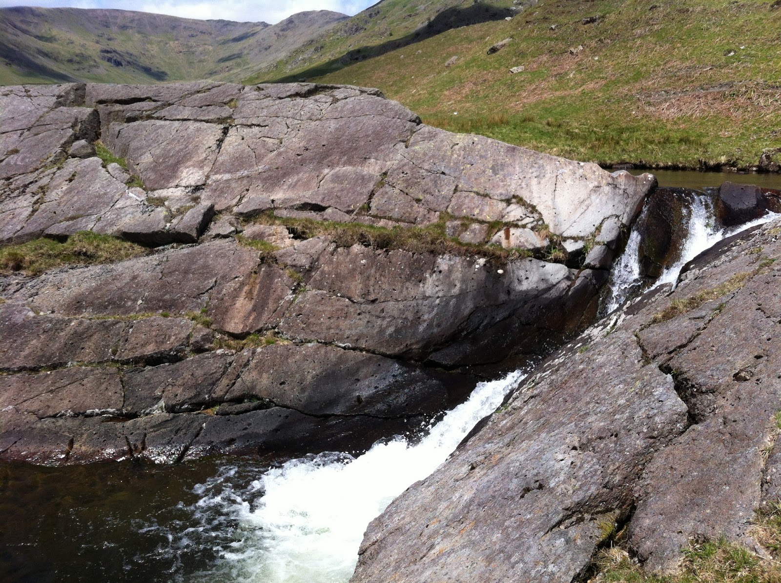
After descending the steep side of Melbreak and running along roads, across a field, bizarrely bumping into a work colleague on the Crummock Water shoreline path, we headed up Gasgale Gill. This is a horrible path and I struggled with energy at this point. After a couple of miles, we got to Coledale Hause but again, in deep mist, took a wrong turn and ended up at the path junction between Crag Hill and Grasmoor. We ran back down (another 2k onto the route) and then eventually found the path down to Force Crag Mine and ran along the road to Braithwaite.
From here we followed roads around to the base of Cat Bells and then along the Derwent Water shoreline path. At the road we met another competitor who was looking for a footpath through the woods to the campsite. We had about 30 minutes left before the course closed but luckily, I was familiar with this path and was able to find the way through. we ran into the camp and checked in with about ten minutes to spare.
 |
| Force Crag Mine - our path is just above and to the left of the river |

Day 2 Camp, Paul all set in his tent |
I stood in the river for a bit to cool off my feet and legs. Then we had a beer, some food and I settled down again for the night.

I was feeling good at this stage, having got the two main days out of the way. I wanted to get my tent up quick in case it started to rain. I thought that it didn't really matter that much if it was raining when I got up because I could quickly pack up and get going.
I had plenty to eat and settled down for the night, stretching as best as I could in my tiny little tent.
The results table on the right shows our day 2 performance. There were five people who did this course on day 2. As well as Paul and myself, who missed two checkpoints, two did the whole course, one dropped out after Robinson's Cairn. Because we missed out High Crag and Red Pike, and because a wet weather course was not officially announced, we didn't get an official ranking. Later that evening, at the campsite, the organisers made an official call that everybody would do the wet weather version of their course on day three. This was because people were taking longer than expected and they wanted to ensure that everybody finished at a reasonable time.
Day Three:
After not as good a nights sleep as the first night, I was up and afforded myself the luxury of an americano coffee from the coffee van before heading off along the road to Ashness Bridge. Day three is traditionally shorter, finishing earlier.
 |
| Day 3 - 16.5 miles |
Day three started with a run along the road to Ashness Bridge, up to Walla Crag, into Keswick picking up the old railway line to Spooneygreen Lan for an ascent of Latrigg. We then ran down the other side of Latrigg, across to the old coach road for a direct ascent of Clough Head which we thought was as easy a way as any to get to the checkpoint on Calfhow Pike. From here we took a, slightly longer than necessary, route back to the event centre at Dowthwaite Head Farm.
 |
| Surprise View |
 |
| Ashness Bridge |
My feet were hurting on the ascent of Walla Crag. I stopped to fix my shoes but not spending enough time doing this, and poor sock choice meant that I started to blister early on in the day.
I was struggling fairly early on, finding the climb up Latrigg tough going but it was the steep climb up Clough Head that really did me in. Once we were up, again in heavy cloud, I got a bit of energy back and managed some running along the top to Calfhow Pike. I persuaded Paul that following the fence line halfway down Mosedale Beck and then cutting across on the contour to Dowthwaite Crag was a good strategy. I don't think he was convinced and in my tired state, I headed towards the wrong path, meaning that we took a longer loop around than necessary.
 |
| Latrigg check point |
 |
| Paul successfully uses his compass to find Clough Head |
 |
| Calfhow Pike |
 |
| sunny Dowthwaitehead |
The last checkpoint was a few hundred metres up the stream and it wasn't until this point that I got the, "I'm going to do this" feeling of completing a challenge.
Running into the field at Dowthwaitehead, Paul and I shook hands and enjoyed the feeling of finishing an epic challenge.
After checking in, and collecting our bottle of cider each, we sat on the grass and tucked into the veggie chilli. As we sat there, the sun came out and the cloud lifted from the felltops. Well, anyone could find their way around when you can see where you are going.
 |
| day three results |
As mentioned above, we didn't get official results because we missed out some checkpoints on day two. We were in 4th place on day one and got 3rd place on day three. The big achievement for me is getting through the three days. I had intended to do the shorter B course but decided to step it up and go for the A course. Prior to this event, the longest run I had done was a marathon so to break my distance record on the Saturday, and then again on the Sunday and still finish on the Monday is a real achievement and I'm really pleased with myself.
Total distance: 74.4 miles
Total time running: 26:14:50
I'm going to have a few days off now.
Update: 10/06/2013
The video is up for this year's event. Wait until the very end!

.jpg)