Wednesday, February 27, 2013

Rivington 26.2 Recce Run

Darwen Tower
The Montane Ultratrail 26.2 Rivington is our next big race.  It's actually part of our training for the Great Lakeland Three Day Race at the start of May.  The Rivington Race is a trail marathon and our aim at this point is completion.  We're a bit behind distance wise due to my knee injury and a bit of impetuousness by Jonathan.  Hopefully we will get up to near 20 miles a few weeks before the event and then taper off in the last few weeks.

The Great Lakeland Three Day Race (GL3D) is something a bit different.  There are three levels to choose from, Elite is approx 30 miles per day, A is approx 25 and B is approx 20 miles per day.  There are three aspects which excite and scare me at the same time.  The first is the three days of running.  We have been trying to do some back to back runs.  The day before our run today I had completed a tough 15 mile fell run.  Jonathan did a 10 mile road race the day after (I only managed a little walk).

The second challenge will be camping out and being mostly self-sufficient over the three days.  Competitors are allowed a 59L dry bag to store all their kit including tent, sleeping bag, food, Nurofen etc.  It gets transported between the campsites.  We're planning to do some two day runs with wild camps inbetween, probably after the Rivington event is out of the way.

Finally is navigation.  I'm getting pretty good, as long as I can see.  I do get a bit lost at times but can find my way back.  I need to practice navigation in cloud or when it is dark.  Jonathan hasn't really done much of this at all and so needs to practice because we're likely to separate out over the three days and he needs to be able to find his own way.

So today was a visit to Darwen for a run around part of the course of the Rivington race.  Unlike the Grizedale race, which consisted of two loops crossing over in the middle, the Rivington course didn't have a natural cross over point.  I plotted a route around the top part of the course, starting at Darwen.  I estimated it to be about 13 miles but about three of those were there to join up the course.

Green line shows the top section of the Rivington course.  The red line is our route.

and again, notice our three mile warm up loop before joining the actual course!

Darwen Tower ahead.  The point where we would try to
pick up the Rivington course.
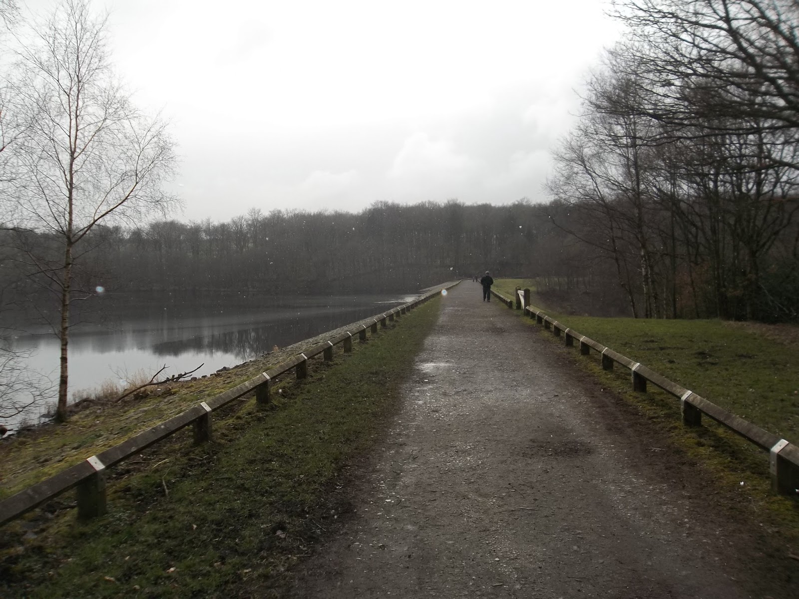
I had found a car park near to the top part of the course.  Once parked up and ready, we headed along a track until we saw Darwen Tower up on top of the moor.

We headed along the side of a reservoir to the tower.

The Ultratrail 26 races have very good logbooks, point by point directions.  They are published on the website and with these, along with the map, it really is hard to get lost.  It's very clear when you are on the right course.

Somehow, we managed to take a wrong turn from Darwen Tower, the very first point that we joined the course.  Maybe it was because we ran up to the top of the tower and back down.  My theory is that running down the spiral steps confused my internal gps and we set off north instead of west.  We looped around, adding approximately three miles to the intended route and then headed off in the right direction.  They all count those miles!

The part of the course we ran on was really nice.  Definitely easier going than the Grizedale Event.  The trail was overall smoother and seemed like it was less hilly.  We ran on the northern section which will be the middle portion of the race route.  We basically followed the route from the tower around to an area called White Coppice where we left the course and crossed the moor, going over Great Hill.  We did take one wrong turn which can be seen on the map above.  This was down to us turning left too soon.  It was our error, the directions were clear enough.  We soon got back on track.

crossing the weir between Rake Brook and Roddlesworth Resevoirs

good trail

The route was a mix of forest/wood trails, some road sections and footpaths.  Further around, on the part we did not run on, it looks like it crosses moorland and there is a big hill (Winter Hill) near the start of the course.  I was a bit sad to leave the course at White Coppice, I felt like I was just getting into the swing of it but it looked like the most sensible place to cross over the moor.  We followed Dean Black Brook east, using it as a handrail feature, until we saw an obvious path a few hundred metres across the moorland and then climbed along a wall to the path.  

following Dean Black Brook

yes you are allowed to sit down on a recce run
After having a sit down and something to eat at an old ruin, we continued up to the top of Great Hill.  This is the central point of this part of the moor.  We could see over to Winter Hill, easily identifiable by the numerous windmills and other masts on it.  

Winter Hill looks like it will be the high point of the course.  Thankfully, it is right at the start of the course and looks like a nice run down the other side.

The run up to Great Hill was very nice, a good gradient, runnable but not easy.  This would be a great training ground.  We had a chat to people on the top where there is a cross shelter.  It was unusual for me to have to check the map to tell people where we had been.  I pointed semi-confidently to Darwen as our start point but had to look at the map to remember White Coppice.

nice track up to Great Hill

Winter Hill

shelter at the top of Great Hill

The run down from Great Hill should have been an easy, soft grassy descent.  Unfortunately today the ground was frozen solid - making for some ankle tweaking clods of mud and grass.  It was very hard going and we were both glad to get to the road.

At the road I gave Jonathan the option of re-joining the course for the last few miles back to the tower or heading straight back to the car.  He opted for the latter option so we headed more or less straight across the road, through a park area and over another road to get back on the track to the car.

down to the road from Great Hill - ouchy!

The last mile or so was on smooth track, downhill.  I really got into my stride and enjoyed it.  It was good to finish strong.  Jonathan was keen to go for an immediate pint but I vetoed this and insisted we went for the curry we had been promising ourselves for the last 16 miles.  Jonathan foolishly filled up on salted peanuts on the way there meaning that a plate and a half was all he could eat at an all you can eat curry house.  I polished off a good three plates and slept it off on the way home while Jonathan drove.  Thanks mate!

aw yeah, I'm happy!

the face says it all!
This was a really good day.  A recce run is really helpful on all sorts of levels.  Things that I took away were ideas such as taking a pencil to mark off the sections as they are done.  I was constantly re-finding where we were in the log book.  It was good to get an idea of how long the drive was, what the terrain was like etc.  It was also good to practice using the log book and map.


I'm not convinced that I picked the best recce route.  We didn't get to run an awful lot of the actual course.  A better route might be from the start round to Darwen Tower and then back over the moor via Great Hill and Winter Hill.  Any recce route on this course is going to involve cutting across unless you take two cars or go out and back.

The event is in about three weeks time.  I'm looking forward to it.  We might even have to have an all you can eat rematch.  Watch this space.

Monday, February 25, 2013

Fell Run, Side Pike, Lingmoor, Wetherlam, Swirl How, Grey Friar, Great Carrs

setting off from Great Langdale, looking towards The Band with Crinkle Crags to the right 

For a lot of my walks and runs lately, I've been going with people who know their way around (although you could argue this on the recent Back O' Skiddaw adventure).

It means that I have been neglecting my map reading practice.

Today I was on my own so I had no option but I was looking forward to it.

Going on my own also meant that I could go where I wanted.  I've been eyeing up this route for a while, it has a bit of an emphasis on unconquered Wainwrights but I also thought it would be a good test of my knee.

I usually make my own way rather than religiously follow a route so I wrote down the main places I wanted to visit.  I spent a bit of time the night before studying the map and picking out key routes I might take.  When it came to applying these routes to real life, I made a few adjustments.  I had picked a different route up to Lingmoor but decided Side Pike needed a visit.  I also missed out Pike O' Blisco, having run past the break off point to the Three Shires Stone and not really having the energy or time to include the last fell in the route.

15 miles


heading down the road towards the campsite and
Wrynose Pass, Side Pike ahead.
I had planned an early start, which meant that my wife would need to drop our eldest daughter off at school.  A missed alarm meant that my early start didn't happen and after dropping my daughter at school (pair of trousers pulled over my running shorts) I headed off to The Old Dungeon Ghyll.

At the ODG car park, I had my usual mild panic that I had not got enough layers.  I put on some running tights under my shorts and thought about adding another layer on top but decided that, despite the icy wind and patchy snow, I would soon warm up once I got a little climbing in.

I was right.  After cutting through the campsite, I was soon climbing up a winding new path on the grassy slopes alongside the road.  The Great Langdale Campsite is a lot bigger than you may think and is ideally suited for big days out.  They had some cool looking caravans set up near the entrance.


Landgdale Pikes from Side Pike

wider shot includes The Band leading up to Bowfell and Crinkle Crags to the left

The climb up to Side Pike is quite interesting, a few big rockly ledges.  At this point my Salomons were still gripping well.  There are paths shooting off in all directions but I stuck to the principle of always heading up and it took me directly to the top.

There were great views of the Langdale Pikes from the top.  I could also see the ridge route around from Swirl How that I planned to take.  

There was a lot more snow on the Coniston fells, luckily I had a pair of microspikes in my bag.

Although the climb up to Side Pike had been interesting, there was something on the descent that I was hoping to find.  The Squeeze is a part of the route where the path goes between a rock face and a vertical slab.  There is no other way around, apart from a difficult climb down, so you have to squeeze through.

I tried to fit through with my backpack - not happening.  So off came the pack and I sidestepped through.  Good excuse for a drink at this point.

The route from Side Pike to Lingmoor Fell follows a wall up to the top.  After an initial drop down and climb up, the route levels out along the top, gently undulating.  This part of the path still had a lot of snow on it which had frozen so progress was a bit precarious.

looking back to Side Pike from the climb up to Lingmoor Fell.  Langdale Pikes to the right

patchy snow higher up, people on the summit ahead

Lingmoor Fell summit.  Swirl How and Great Carrs to the left.  Pike O' Blisco to the right above the trees.

Langdale Pikes from Lingmoor Fell summit cairn

the route I planned to take -  Wetherlam to Swirl How, after nipping across to Grey Friar, I would come back to Great Carrs and down Wet Side Edge.

crossing Wrynose Pass
From Lingmoor Fell, I followed the wall down to the road (Wrynose Pass).  From here I followed Bleamoss Beck down to the road.  This was really nice running.  Levelish and a good track through the field.  There were a few muddy patches to negotiate but I got through more or less unscathed.

I came out at the road by Fell Foot and ran around the road to Fell Foot Bridge where I crossed the River Brathway and took the track past Bridge End Farm before heading up the side of the fell.  The wall here was solid and high and it took me a while to find a decent place to climb over onto the Greenburn Mine track.  I carried on along here until I decided to head directly up onto Birk Fell and then over to Wetherlam via Wetherlam Edge.  On the higher parts of the climb up Birk Fell, I managed to get in the middle of a forest of gorse bushes, on steep ground with frozen snow on the ground.  It was tough going.  Shortly before resorting to crawling on my hands and knees, I managed to find a track and followed it out of the trees and on up to the summit of Wetherlam.

Bridge End Farm

Fell Foot Bridge

looking back through the gorse

heading up now - snow and ice

micro spikes
Once at the summit of Wetherlam, I could see most of the route I wanted to take.  

I saw that there was a steep drop and climb back up Prison Band to Swirl How.  

This area was covered in quite a lot of snow. It was very easy running on the downhill.  

The spikes were working well and the snow was frozen hard, making a smooth and even running surface.  If the gradient got too steep though, it was a different story and I had to zig-zag across to prevent a slip and a long slide down.

from the top of Wetherlam, looking over to Swirl How, Broad Slack and Great Carrs

looking North, Pike O' Blisco is the triangular fell on the right

Coniston Old Man to the South.

Levers Water on the left with Prison Band (the way up) ahead

busy as usual up there

up to Swirl How summit

Swirl How
There was more snow and ice on the climb up Prison Band to Swirl How.  I was getting a bit tired at this point so took my time.  The usual rocky route was smoothed out by the snow but I did find myself trying to climb up some very steep sections.

Footprints that had been left in previous days had frozen solid and acted as steps at points.  After a bit more climbing, the gradient mellowed slightly and I picked up a track to the summit.

As I messed around on top, taking pictures, I saw a huge party of people making their way over from Coniston Old Man.  Rather than hang around chatting, I headed off towards Grey Friar.

The route, again smoothened by snow, was a really nice gradual downhill.  The snow was consistent and hard so I picked up some speed as I headed over.

Picadilly Circus

Brim Fell and Dow Crag from the run down Fairfield from Broad Slack
Dow Crag from Grey Friar Summit
Harter Fell from Grey Friar summit

It was fairly easy going back from Grey Friar to Great Carrs.  This was the one point that I took a grid reference from my GPS as I was not sure where on the horizon the top of Great Carrs would be.  It turned out that I was heading the right way and so I carried on to the top.  I looked around for a bit for the plane wreckage but could not see it, perhaps it was hidden in the snow.

back to Swirl How from near the summit of Great Carrs

around the rim

circular wall
The run down the Wet Side Edge was hard going. The ground was lumpy and very hard.  There were lots of steps down, including a few craggy parts.

My plan was to pick out the junction in the path leading off to Wrynose Pass and the Three Shires Stone.  From here there is a decent path that leads up to Red Tarn and then a steep but short climb to Pike O' Blisco.  I ended up overshooting.  When I worked out where I was on the map, I wasn't very motivated to climb back up to pick up the path so I didn't deliberate for too long before deciding to miss this part out.

Down below, I could see a circular stone wall that was recognisable on the map and so I headed for the corner of this.

From here I got onto a good path leading along the West side of Blea Tarn and back down through the campsite to the parking place.  My watch just clicked on to 15 miles as I reached my car (I might have done a lap of the car park if it had not).  After getting changed, I resisted the temptation of a pint at the ODG and headed straight home, happy with my lot.

back at Blea Tarn