Saturday, September 29, 2012

Ullswater Fell Care Day


team brief at Glenridding Village Hall
Thursday was the Ullswater Fell Care Day, an event run by the Flora of the Fells project to show interested members of the public some of the work done by volunteers.  

There was the opportunity to take part in various activities including dry stone walling, litter picking, making bird boxes as well as a number of drain runs organised by fix the fells.

The fix the fells team were out in force, from the choice of routes on offer, I asked to do one of the harder routes and was assigned to the route from Mires Beck up to Red Tarn returning by the Greenside Mines.

After a quick talk about the day in the village hall, we headed to the car park to divvy out tools.  We had a large group with us, including some National Trust rangers.

tooled up

enforced tea break
As we headed up the path, there was an opportunity to talk to the people who had come for the day about the various tasks involved in a drain run.

Obviously, one of the most important items to cover was the obligatory 11am tea break.  I did have to insist quite firmly that we did actually stop for the tea break.  The people I was with were quite keen to carry on.

I got talking with a couple of fell runners, one of which, Penny, is planning a Bob Graham Round next year.  I think they were a bit surprised at the easy pace of the drain run, expecting harder work.

I explained that, with such a large group, things would tend to move slower and that some drain runs consist of two people or even solo drain runs on some of the shorter paths.

Tanya's white jacket
After a little bit more work, we were at Red Tarn and ready for a lunch break.

It was at this point that I realised that Tanya, who is the programme manager for fix the fells, had been suffering on the way up from attempts by others to get her pristine boots, jacket and trousers muddy.

Chief instigators seemed to be Sarah and Martin.

As we set off, and crossed over Red Tarn Beck, I saw Martin with an evil grin on his face.  He was obviously up to no good so I quickly scurried up the other side of the beck out of harms way.  This also proved to be an ideal place to capture the attack.

Martin, waiting to add an extra stone to the crossing

Tanya demonstrates poise and calm, holding tightly onto her lady spade during the attack

on the way down looking back up towards Red Tarn and Helvellyn

The path on the way down was in a pretty good state of repair.  I somehow managed to swap my spade for a brush which was not particularly useful so I did a lot of directing and 'managing'


We did eventually get to a steep section of pitched path that needed a good sweep off.  As the only person with a brush, I was put to work.

Before long we were back at the village hall where there were plenty of refreshments available.  Hopefully everyone who took part had a good time and maybe we persuaded a few more people to volunteer.

There is another fell care day in Windermere on the 25th October for anyone who wants to have a go.

Wednesday, September 26, 2012

Lake District 100 Cycle Sportive 2012


Well, if we achieved everything we set out to do in life it would be pretty boring eh?

I first entered the Lake District 100 mile cycle sportive in 2011.  It is a charity event for Action Medical Research.  They hold sportive events around the country.  I had previously entered a 57 mile sportive, the Cumbria Christmas Cracker and had been looking for a longer, more challenging event.

When it came down to the training though, I did a few longish rides but, with about a month to go, I had not put the work in and did not feel up to the task.  I had yet to conquer any of the major lakeland passes on my bike.  I contacted the organiser and asked if I could defer entry until this year. They agreed and that was that. 

Not too long ago, my friend Jonathan bought a bike.  When I told him that I had the 100 mile event coming up, he was up for it.  Not being one to dash dreams, I agreed to ride around with him.

Coming up to the event he was pretty nervous.  I got a few frantic text messages, he was panicking.  He went to the bike shop the day before and overheard some people talking about how tough the event was.

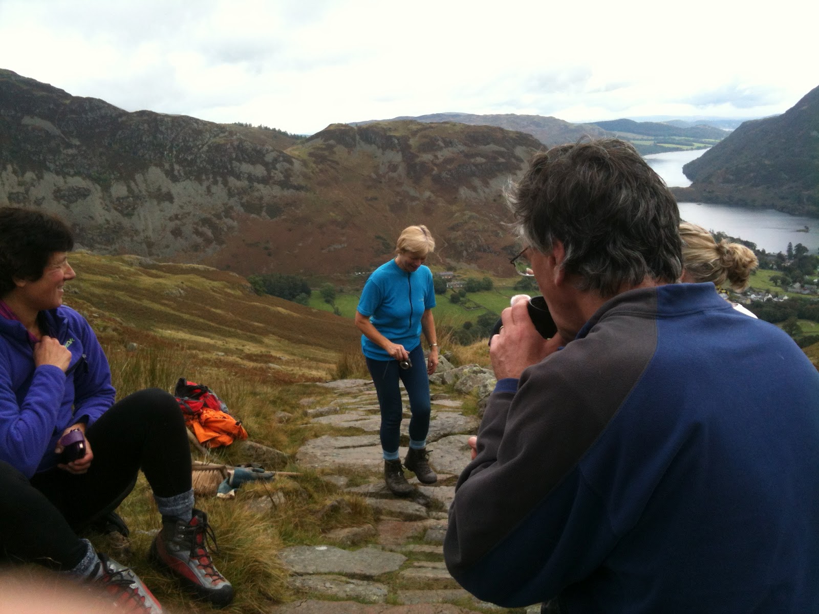
a few nerves at the start, note my fan club seeing us off
After a bit of a pep-talk, he was good to go.  I had decided that 10 hours was a good time to aim for.  Jonathan seemed to think that this was quite long but I felt that, with the steep climbs and fuelling stops, this would be about right.

looking over Derwent Water
We had perfect conditions as we lined up in Fitz Park to be set off.  The first part of the route was a nice easy 10 miles around to Seatoller where, perhaps the hardest climb of the day starts up and over Honister Pass.

Riding along the back of Derwent Water with Catbells on our right, there was a misty cloud hovering over the lake.  I told Jonathan to forget his pride and, rather than burn his legs out trying to power up the 25% slope of Honister Pass, that he should get off and walk if it got too hard, preserving energy.  I said that I would do the same and that the day was all about energy preservation, recovery and pace.  He agreed that this would be a good strategy and so of course, when we got to Honister Pass, we both set off up the hill with no intention of stopping.
  
top of the first section of Honister Pass
What made things worse was that somebody overtook me on the climb.  "Slow and steady, wins the race" I thought, and I could see that they were really pushing, standing on the pedals for a long time.  A minute or so later, I span past them as they stood at the side of the road trying to get restarted on the steep climb.

I've been over Honister Pass before.  It's steep and direct.  It's probably the hardest out of the passes I have been over.  I waited for Jonathan at the top of the first steep section, after the cattle grid and then we carried on up to the slate mine.  The second section up to the slate mine is relatively easy.  The descent down the other side is very steep and a bit technical.  There are two bridges in a row where the road turns and it is easy to misjudge.  On this occasion, I had a car in front of me which, probably helpfully, tempered my speed.

nearing the slate mine
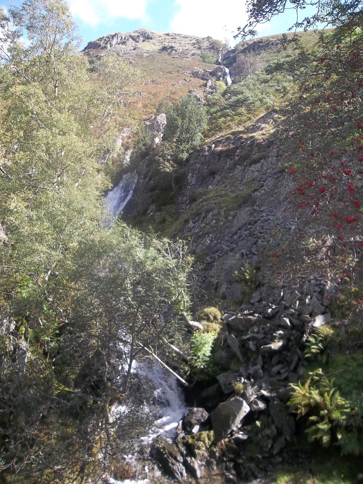
The valley from the slate mine down to Gatesgarth Farm is a beautiful area.

Honister Crag is quite something to behold.  If you look closely, you can see rope bridges and other equipment installed by the slate mine company.

The Via Ferrata experience is something I would like to try.

My general photography rule; take pictures going uphill, go fast downhill; applies just as much to cycling as it does to running.  Therefore, I didn't take any pictures of this section of road.

I have been over Honister Pass the other way though, when I pretended to do the Buttermere Triathlon, and on this occasion, I did get some pictures of this section.  Below is one of my favourites:

from another blog post - Honister the other way

Along through Buttermere and a quick toilet stop before heading back up to the climb up Newlands Pass.  This is a steep pass but I don't find it as difficult as Honister.  Newlands is a long climb but it has sections that level out a bit, giving a much needed rest.  It gets steep near the top but it is only at the very top.

heading up Newlands Pass.  The road goes over the col in the middle of the picture

top of Newlands Pass Whiteless Pike and Wandope behind?

fast descent
Descending from the top of Newlands Pass is fast and straight.  You can go as fast as your bike will let you.

Once down Newlands Pass we had a middle size challenge of Whinlatter Pass ahead before some flattish roads.  It felt good to get Honister and Newlands passes out of the way so early on.  The road from the top of Newlands to Braithwaite is smooth and quiet.  It goes along the bottom of the screes of Barrow (have a look at this blog post of us running down these screes) before arriving in Braithwaite and turning immediately up Whinlatter.

Whinlatter is an entirely different affair in terms of a steep lakeland pass.  It goes through a forest and is a series of medium steepness hills.  It's a fairly long climb but then not that difficult a climb.

bit of traffic on Whinlatter Pass

From Whinlatter there is a nice downhill into Lorton where the first food stop was.  I had been making sure I drank and ate to keep my energy up.  I had also been telling Jonathan to do the same.  I had planned a nice easy refuelling stop at Lorton but then Jonathan told me that the cut off point was just up the road and we had ten minutes to get there otherwise we would have to do the 100k rather than the 100mile route.  So, after refilling my bottle and scoffing down some flapjack, we set back off.

The Lorton fuel stop was at 28 miles but was also after getting all but one of the difficult lakeland passes out of the way.  

From Lorton we headed out past the north end of Bassenthwaite and round the back of Skiddaw through Caldbeck, Hesket Newmarket to the next foodstop at Greystoke.

These were flatter roads but Jonathan was struggling with the mileage.  He had started to experience hip trouble and cramp.  

By the time we got into Greystoke, we had slipped behind the 10hour schedule.  I was aware that we were probably the last people still attempting the 100mile route.  

Ullswater, a very happy sight
Lots of people had chosen to change to the 100k route after the checkpoint at Lorton.  Others had taken a direct route back to Keswick.  

Jonathan was keen to continue but I knew that we were unlikely to make the full distance.  

We asked a volunteer about cut off times and it was clear that we would not make the rest of the journey in time.

We considered our options and decided to continue to Glenridding where I arranged for my wife to come and pick me up.

We informed the race marshalls and set off to Glenridding.  We ended up covering 67 of the 100 miles.  I was a bit disappointed not to have completed the ride but knew that it was the right decision.

helmet hair
At Glenridding we put the bikes on the car and then went into The Glenridding Hotel for some chips and onion rings, and a beer.

A nice long soak in the bath was called for when I got home, along with some salty snacks and more beer.

I had a very good sleep that night.

Although we didn't complete the full distance, we still had a good day and I think we gave it a good effort.  I think we will be back for another try next year.

I think Jonathan was a bit achy, I did hear that he sent his dad to the garage for an emergency lucozade.  I wonder if he has recovered?


Tuesday, September 25, 2012

Helvellyn, Dodds and Pikes


There had been some excitement in the Facebook groups and Twitter feeds about this weekend.  For one thing, it was a weekend.  For another, the forecast was for definitely no rain at all.  I took the opportunity of running a route I have been thinking about for some time, climbing up from Wythburn Church to Helvellyn and then running along the ridge to bag some Wainwrights.

route

The Ws on the map are Wainwright fells.  A red W denotes a previously bagged Wainwright, here you can see Helvellyn and Catstycam already in red.  A black W is a Wainwright yet to get.  I'm making progress on the Wainwrights.  My full progress is here.

Wythburn Church
Parking spot today was the United Utilities Wythburn Church car park which is towards the South end of Thirlmere off the A591 (NY 32590 13566).  

Apparently, there have been lots of problems here with car crime.  The car park is tucked away behind trees but is also close to the A road.  So there is cover and a quick getaway.  

Add to this the fact that anybody parking there would more than likely be doing a walk of a few hours or more and you can see why.  There was an angry note to United Utilities and the police on the ticket machine, obviously left by someone who had been the victim of a crime.

cloudy Thirlmere

Driving through Cockermouth and Keswick, there was thick mist.  I was really hoping to get up high on the hills early enough to see the cloud before the sun burnt it away.  When I got to Thirlmere, there was still some cloud hanging low over the water but I knew it would not be around for long.

I climbed up through the woods on the path that starts at the North end of the car park.  This is a fix the fells path and I had previously spent a very muggy morning digging out pine needles, scraping off stones and tidying up this path.  I remember laughing at the people wearing nets over their faces until the midgie bites started to itch.  We ended up abandoning the work near to the top of the path because the midgies were so bad.

Walking up today, the stone path seems to be holding up quite well but there are a few full drains.  Further up there are some overgrown fir trees that are spreading over the path, making people walk around, creating a new path.

Once out of the woods, the path continues to wind and climb up onto Comb Crags and Birk Side before levelling out to the flattish tops of the long Helvellyn ridge.  

My route today was going to take in most of the major peaks along this ridge.  This is also the same ridge that makes up most of the second section of a Bob Graham Round.

a bit of cloud left over Thirlmere, from the climb up

Harrop Tarn in the centre of the picture, across Thirlmere, Tarn Crags behind to the left

Before the path joins and heads up towards Helvellyn, I cut across towards Nethermost Pike and headed south along the ridge towards Dollywagon Pike.  This part of the run was really nice and flat, just some gentle up and down hills along the ridge.  

along the flat tops to Dollywagon Pike with St Sunday Crag across Grisedale.  I think that is High Crag on the right

High Crag summit

High Crag was quite a spectacular place to be on a clear day like today.  I was again practising my map reading.  This time I was using Harvey maps as they tend to be the ones used in mountain marathon events.  The Harvey maps differ quite a bit to OS.  Harvey maps are generally 1:40k where OS are 1:25k.  Some people say that the Harvey maps are less cluttered.  I found that some of the things I had been using for navigation using OS maps, such as walls, or "boundary features" are omitted from Harvey maps.  I have to agree that they are clearer for working out contours, or the shape of the land.  I also found them to show cairns clearer which is something I used to know I was at the top of a fell.  I did get a bit mixed up along the ridge from Nethermost Pike to Dollywagon Pike.  I think I initially mistook High Crag for Dollywagon Pike.  There is every chance that I have mislabelled some of these pictures.  If you spot a mistake, please let me know and I will correct it.

from High Crag looking North East

One of the most satisfying things is being able to look at and name distant fells.  Each walk or run that I do builds my knowledge of the Lake District, it's great how it is all fitting together in my head.  Alan and David who I did the recent Scafell Range walk with definitely have an encyclopaedic knowledge of the Lake District, naming crags and routes as well as the fells themselves.  I'll get there.

from Dollywagon Pike looking back towards Nethermost Pike and Helvellyn

Standing at Dollywagon Pike, it was clear, cold and crisp all around.  I took what felt like hundreds of pictures, knowing that most of them would be deleted as they were almost exactly the same as the last one.  The route from Nethermost Pike along to Dollywagon Pike is about 1k and is definitely runnable but it took me a long time due to the constant photo stops.  I make a joke of stopping to take pictures as a reason for having a rest but I really was stopping to take pictures today.  

the path I took back over Helvellyn is visible on the left rising up High Crag.
Nethermost Pike is in the middle with the sharp ridge of Striding Edge behind.

Dollywagon Pike

Dollywagon Pike has two distinctive cairns.  The Harvey map shows these clearly so I was certain that this is where I was.  The other thing that helped me find my position was the very steep drop down to the south which would lead to Grisedale Tarn but is not visible from the top.

Dollywagon Pike looking over Ullswater and Place Fell

Standing at the eastern cairn on Dollywagon Pike is a fantastic place to contemplate the beauty of the Lake District.  The eastern fells to the, err.. east, an area I have been exploring quite a bit recently with walks and runs around High Street, Haweswater and the closer Grisdale/Glenridding area.

Striding Edge with Catstycam peeping over as it does
to the East, St Sunday Crag from Dollywagon Pike

After spending some considerable time at Dollywagon Pike, this really is a beauty of a fell, I retraced my steps back towards Nethermost Pike.  I stuck to the edge of the cliff, meaning a slight downhill, then up hill to High Crag and then up a bit more to Nethermost Pike.

back at High Crag, Skiddaw visible behind

St Sunday Crag and Fairfield across the valley

Looking south west, on a clear day like today, you can see almost the whole of the Lake District.  There were some really clear fells that I was able to pick out with their distinctive shape, height or location.

Ok, here goes, I would say that is Great Gable prominant on the left with Pillar middle right and perhaps Grisedale Pike on the far right?  Cat Bells is in the middle ground with most of the Newlands Horseshoe visible.  Just beyond the round ridge of Nethermost Pike in the foreground is the Bleaberry Fell, High Tove area.  How did I do?

The top of Nethermost Pike is like the aftermath of a huge rock explosion.  Boulders are laying around the flat top, angling towards the sky.

approaching Nethermost Pike

Helvellyn and Striding Edge (don't forget Catstycam) from Nethermost Pike summit cairn

ah, that's how the timer works

looking south, along the ridge I have just been on

I then headed up towards Helvellyn.  This is a very popular fell and it is obvious why this is the case.  I could have maybe pushed myself to run up to the shelter but it was very easy to convince myself that I needed to walk so that I could take lots of pictures.

heading up to the cross shelter on Helvellyn

On the way up, I passed a stone marking the site of the first aeroplane to land on a mountain.  I remember thinking that it was not the flattest part of the mountain to land on.  This link gives a full description of the event.

well, I've seen plenty of mountainbikes up here but...

Up on Helvellyn, I've been here before.  In fact, after the walk, I looked back at my blog post of my first ascent of Helvellyn with my old dog Oscar.  That's one of the great things about having a blog, it's a great record of past exploits.  I'm probably the person who looks at it the most, reminiscing.  Of course, there are plenty of people looking for pictures of Terri Hatcher naked who end up here too.


Walking, rather than running, along the top, I passed Striding Edge and Swirral Edge leading to Catstycam.  I like Catstycam, it's a cheeky little fell.  In the midst of the epic grandeur of Helvellyn's ridges, tarn and plateau, it commands attention simply by being mountain-shaped and hard to spell.  I bagged Catstycam a few weeks back.  You don't go there unless you are going there, it's not on the way to anywhere.  I'm sure a lot of people go there and then back the same way, a bit like Barrow-in-Furness.

cheeky little Catstycam

Red Tarn, Striding Edge, High Street at the back

path towards Helvellyn Lower Man visible over the start of Swirral Edge

now this is where I would land an aeroplane - perhaps there were too many people there

looking down Swirral Edge to Catstycam


Just a little bit on from Helvellyn, there is a cairn marking Hevellyn Lower Man and the path splits with one branch heading off towards Browncove Crags.  I took the right hand branch, heading down a steep and rocky track before climbing back up to the summit of White Side.  Looking back Helvellyn and the unmistakable profile of Catstycam looked magnificent.  I don't often see pictures of Helvellyn from this side.


west, over Thirlmere

back towards Helvelyln, Browncove Crags visible now on the right

White Side summit

Raise and Stybarrow Dodd, my direction of travel

summit of Raise

Raise summit cairn on the right looking back towards Helvellyn

Now I have been up Raise before.  It was about 20 years ago and two friends took me snowboarding.  I knew nothing about the Lake District and, coming to think of it, we were incredibly stupid and unsafe.  I didn't have waterproof boots so I wore carrier bags on my feet.  The friends I was with were keen snowboarders and would come to Raise quite often.  The Lake District Ski Club are based on Raise.  They have recently found fame for installing a toilet in the club house.  I wanted to have a look at the ski-tow so I diverted slightly off the route.


I then headed back onto the main path, across Sticks Pass and up to Stybarrow Dodd.  This part of the run was grassy and bumpy rather than rocky.  The top of Stybarrow Dodd in itself is not that wondrous a place but the views out are.


From Stybarrow Dodd up to Watson's Dodd is a bit of a boggy trod.  I managed to jump over most of the big boggy bits but the ground was wet.


Watson's Dodd summit with Great Dodd behind

It was not all that long ago that I was at the other side of Thirlmere doing a quick drain run for fix the fells.  I took the picture below which is zoomed in on the route from Stybarrow Dodd on the right down to Watson's Dodd on the left.  The deep gorge is Stanah Gill and was roughly the way I descended.

looking across to Watson's Dodd and Stybarrow Dodd from Armboth

Heading down from the top of Watson's Dodd, I saw a building that would act as a good reference point for re-joining the track.  It turns out that it was a (well built) sheepfold.  Not a bad place to count your sheep.

Sheepfold with Skiddaw range behind

The path re-joined the Sticks Pass path and I headed down steeply.  I decided to use an aqueduct as a 'handrail' feature.  This is much clearer to see on the Harvey map than on the OS.  The good thing about running along the side of the aqueduct was that it was flat and direct.

steep descent towards Thirlmere

Fisherplace Gill waterfalls

that's reassuring

the aqueduct

The aqueduct brought me out at the Swirls Car Park.  From here it was about two miles on the forest track back to the path down to Wythburn.


great place for a sit down

The overall distance was about 13.5 miles.  I headed into Keswick where I refuelled with chips before heading home for a bath.  Another six Wainwrights claimed today, beautiful conditions, a happy man.