Monday, May 28, 2012

Bike Ride to Watendlath

I was planning a bit of a Brick session - ride to Watendlath, meet Fiona and Hannah with the car and then run over the trail to Rosthwaite.  We ended up getting to Watendlath way too late to contemplate a run and so just put the bikes on top of the car and headed home.  Hannah ended up going to bed two hours late - oops!

nice quiet roads most of the way
 
 
quick stop at Surprise View


cows on the road

the stats (click for larger view)

Sunday, May 27, 2012

Skiddaw - Fast


Jonathan's cousin, Gerard, is in training for a Bob Graham Round.  Jonathan said that we were going to meet at Seatoller to run up Scafell, or Scafell Pike, he wasn't quite sure, he thought it was the higher one, which he thought was Scafell.

Turns out we were meeting Gerard at Seathwaite, where he was camping, and then driving to the other side of Keswick to support him running up Skiddaw.  We parked on Brundholme Road and headed up Spoonygreen Lane.  Gerard ran back into Keswick to start from the Moot Hall because he wanted to, "do it properly".


Heading up, views of Derwent Water and beyond opening up.  I think I got to about the top of Jenkin Hill before Gerard caught up.  I was able to keep up with him to the top although it's worth pointing out that part of the reason of us being there was to make sure he paced himself.  He was planning on running approximately 40 more miles that us.

Gerard running over the top of Skiddaw

Once at the top, he thanked me for helping and then ran off into the distance.

looking over Longside Edge towards Whinlatter Forest and western fells

Jonathan makes it to the top

I tried to climb on top of this trig point but was blown off by the really strong wind on the top.

me, falling off the top of Skiddaw

very windy


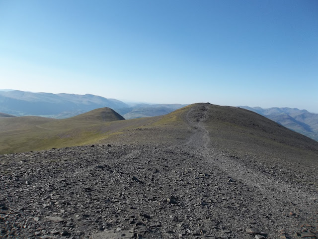
looking back down the summit path with little man


it's 8am

Enough getting blown around on top, now time for a quick run down.

down at the gate


Always a bind running down a big hill, wanting to keep going but the scenery is so beautiful so end up stopping for photos.  I tried something a bit new but not sure if I can say that this particular scenery was beautiful...

running while taking photos


wheeee!

Back down and safely in Costa for 9am.  Jonathan had further support duties to perform so he went and got a paper to read.  I was off to fix the fells.  I phoned him when I had finished my day and he had just been up to Grisedale Tarn to meet Gerard, he didn't seem too happy about this and was guzzling red berry coolers from Costa.

Thursday, May 24, 2012

Little Coledale Run

There is a classic route in the Lake District involving some great mountains, brilliant views, nicely undulating ridge lines and a pleasant ascent and descent.  It's called the Coledale Horseshoe.  This isn't it.  It's not that I got lost exactly, but when I knew we were on a different path to the intended climb up Sleet How towards Grisdale Pike, I decided that we should carry on and adapt the route.  The fact that we were both feeling pretty sluggish was a major contributing factor to this decision as the route we took was flat (at least initially).  

So, after parking under the scree slopes of Barrow, we ran through Braithwaite and up the start of the Whinlatter Pass until the point where the intended and non-intended paths start.  The non-intended path (the one we took) joined up with the track that leads to Force Crag mine and is a pretty level dirt track all the way along the bottom of the valley.

Looking down the track towards Force Crag mine, Outerside on the left with Sail and Crag Hill/Eel Crag behind.  Slopes of Grisdale Pike on the right of the picture.

The track continues over Coledale Beck and on over Coledale Hause.  We branched off to the left after crossing the beck and took the steep and direct route up to Outerside.

Force Crag Mine

steep

Sun over Grisedale Pike & Hopegill Head

top of Outerside looking down on Barrow in front and on to Derwent Water

looking down on the track we took on the other side of the valley

Jonathan after suffering severe cramp on the way up Outerside

chief navigator


we came along the side, rather than over the top of Barrow (bad move).  The scree slopes are in front

Jonathan's car at the bottom of the scree.  Hmm, how can we get down there fast...

me

Jonathan

profile shows steep ascent of Outerside and then at the end the steep descent down the scree of Barrow

Tuesday, May 22, 2012

New running partner


Hannah is getting pretty fast on her bike.  Today we put her to the test by heading to the cycle track and pointing her towards Asda.  I ran alongside.  She kept up a pretty good pace, stopping only for a pretend drink and to get her knickers out of her bum.


The cycle track runs along an old railway line so is fairly level and straight.  There is no traffic apart from dog walkers and other cyclists.
 

Today we managed the whole journey without falling off which hasn't always been the case.


Three miles, which was a nice run for me.  As an additional bonus, when we got to Asda, Fiona had already done the shopping.  Here are the stats:


Sunday, May 20, 2012

Cycling Progress - Whinlatter Pass

Completed an ascent of Whinlatter Pass this evening.  It only scores a 5/10 in 100 Greatest Hill Climbs and it was fairly easy despite being pushed off the road by the new 800 bus service on the steepest part of the climb. The 800 service is a new service which allows people to take bikes on board, ironic huh?

Here are the stats for the ride.  I'm very happy with my overall pace only really slowing down at the very end (apart from the climb section).


Split
Time
Distance
Avg Speed
Summary2:16:28.731.5513.9
14:15.71.0014.1
22:43.41.0022.0
33:39.11.0016.4
43:10.61.0018.9
54:01.41.0014.9
64:18.11.0013.9
75:32.81.0010.8
83:24.71.0017.6
93:32.21.0017.0
102:55.01.0020.6
113:09.31.0019.0
123:27.81.0017.3
133:20.71.0017.9
144:58.31.0012.1
155:01.51.0011.9
164:12.21.0014.3
176:30.81.009.2
1810:05.31.005.9
196:22.41.009.4
203:20.61.0017.9
212:43.41.0022.0
222:53.01.0020.8
233:13.71.0018.6
244:27.31.0013.5
254:05.61.0014.7
265:53.51.0010.2
275:14.31.0011.5
284:30.31.0013.3
293:38.31.0016.5
303:41.11.0016.3
315:56.21.0010.1
322:10.60.5615.4


Elevation - see if you can tell where Whinlatter Pass is?

Back home for a healthy dinner of onion rings, pineapple and banana in soya custard to replenish lost energy.