Sunday, December 28, 2014

Helvellyn to Calfhow Pike

Helvellyn summit

This running every day in December thing has got my legs a bit sore but I was determined to get out today on some high, snow covered fells.  The forecast was great and, as we drove towards Keswick, the skies were clear.  As we turned past Bassenthwaite, and got our first views over to the Dodds, we were a bit surprised to see heavy cloud cover.

Having failed to amass seven pound coins to pay for parking at Whythburn or Swirls, we moved slightly north of the Swirls car park into a layby.  I've nothing against paying for parking but it would be helpful if these machines took cards as many now do.  We ran up to the Swirls car park and then took the path up over Browncove Crags to Helvellyn summit.  A thin layer of snow started quite low down but it wasn't icy and we actually managed the whole day without the need for microspikes.

As we climbed, it looked as though we might get above the cloud and towards the last few hundred metres of ascending we did.  This gave an additional reason to stop as well as the usual photo opportunities, we could use the excuse of naming distant fells.

clear skies now above Browncove Crags

above the cloud

The summit of Helvellyn was eerily quiet.  We considered carrying on over to Dollywagon Pike but instead turned around to start heading over to the Dodds.

from Lower Man, heading up towards the summit - beautiful Catstye Cam across Swirral Edge.  Plenty of cloud inversions to the east as well.  Beautiful day.
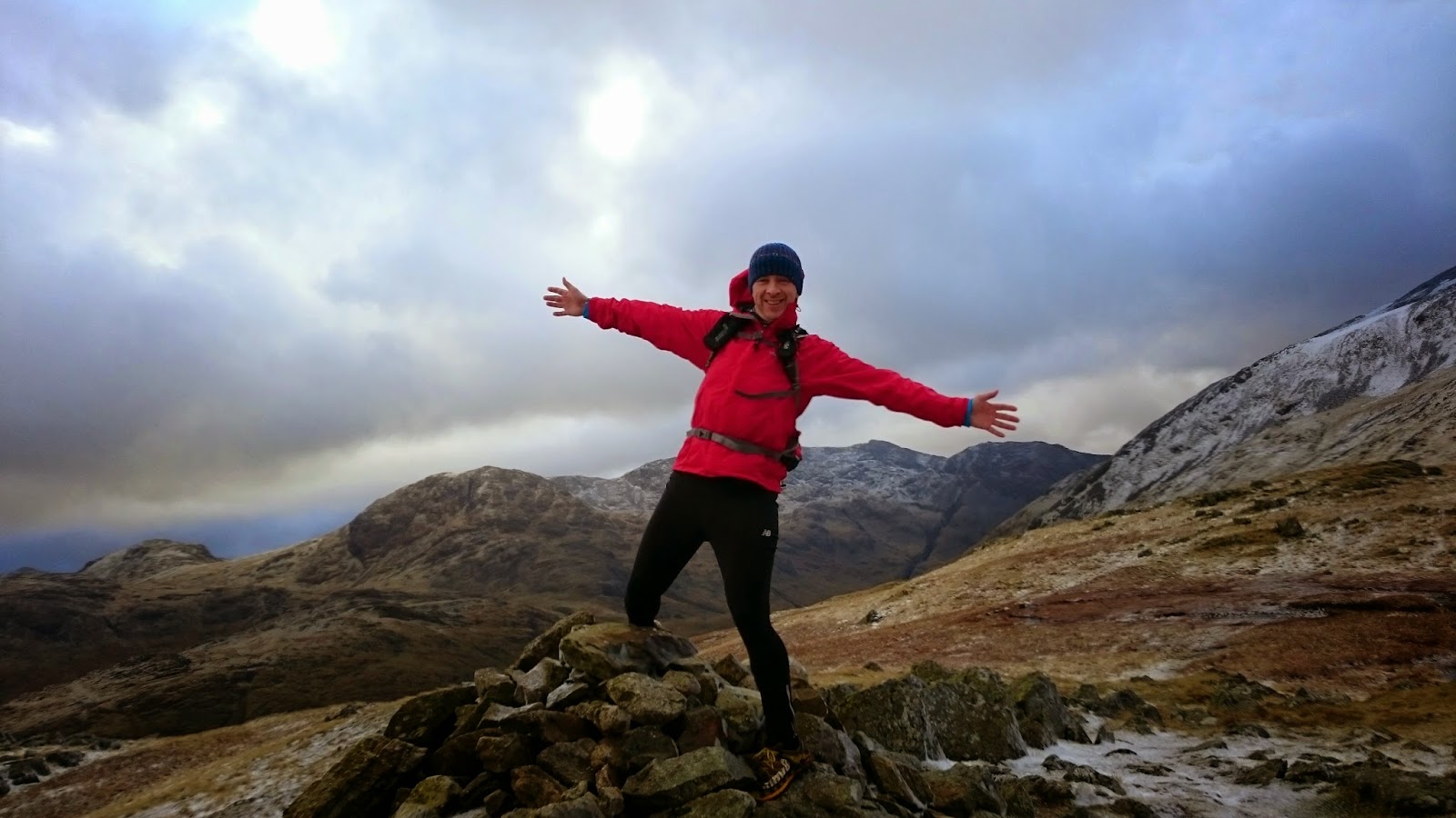
at the summit trig

From Lower Man, there is a nice winding path down to the start of the climb up to Whiteside.  I've got a new phone and it does some cool things with pictures.  Unfortunately, it seems to decide at random what these things are.  We took a series of pictures hoping the phone would make them into an animated GIF.  It worked for Jonathan:


It didn't work for me though, it made the pictures into a panoramic.  Here's a pic of me running down the same section though:


Raise summit
We carried on over Whiteside and over to Raise, stopping on the way down to watch a lone snowboarder on the ski slope.  The lift was working.  I wouldn't say that the conditions were fantastic for skiing or snowboarding although it would have been fun traversing over the Dodds today.  We saw a few different tracks of people that had done just that.

ski lift on Raise
Just before Sticks Pass, we ran into Andrew Foster and Lesley Whittaker, people who I had never met but recognised from various antics on Facebook including being top contributors to my very own Summit Dorks group, the purpose of which is to record acts of daftness on top of mountains.  We chatted for a while, took a few photos then went on our opposite ways.  Lovely people.

Dorks
We told Andrew and Lesley that we were heading down Sticks Pass but, even though it was only about 20 feet from where we left them, we had changed our minds by the time we got there and decided to continue on to Stybarrow Dodd, over to Great Dodd (missing out the detour to Watson's Dodd summit) and then enjoying a nice run down to Calfhow Pike where we decided to adventure down a dodgy looking path on a part of the map where the lines are close together and there are lots of craggy bits.


The path down to Fornside Farm was not very pleasant.  At least it wasn't icy but it wound very steeply through the crags.  On reflection, we would have been better carrying on to Clough Head and taking one of the paths or the blunt slope down to the old coach road. Although it would have been a few miles extra, it would probably have been quicker.  Oh well. Still some new ground found.

I couldn't see a legitimate way across to the road but there is a permissive path through Fornside.  Once out on the road, Jonathan took a real dive, hurting his ankle quite badly.  It turns out a pothole had jumped out and swung his legs from under him.  He made quite a clunk as he slapped against the road.  Yes, Helvellyn in the snow - no problem.  Flat road with a little hole in it - floored!

We walked quite a bit of the rest of the route.  Luckily, we only had about three miles left to go and we just ran bits that Jonathan could manage with his cankle.  We took a nice bit of track around the south end of High Rigg (I'll be back here to explore) and then crossed the A591 to pick up the Great How path, continuing on along the side of Thirlmere, back up the road from Dalehead Hall Hotel and a hundred metres or so along the road back to the car.  Day 28 of run every day in December was a good one.

from Great Dodd summit shelter looking back over ground covered

bridge over St John's Beck with Blencathra behind.  We had just descended the crags on the right

last leg - along the forest track at the side of Thirlmere


Friday, December 26, 2014

Raven Crag and High Rigg

from the start, bit rainy but the car park meter wasn't working - every cloud....

Raven Crag from half way through the woods
A Boxing Day outing has become a bit of a tradition ever since, three years ago, Jonathan had his first fell walk up Dodd, then on to Carlside and Longside Edge.  He's come a long way since, dropping lots of weight and becoming a half-decent runner.  Good on you brother.

We had vaguely talked of "something epic" for this year's Boxing Day run but, as Christmas Day came to a close, I was feeling rather bloated and sent a text suggesting that we meet up a little bit later and don't go quite as far.  Jonathan, as ever, was happy to go with it.  

Jonathan on Raven Crag
The climb to Raven Crag from the car park at the bottom is straight forward navigation, run along the road a little bit and head up the signposted footpath.  We tracked on the map as it passed over two forest tracks and then found the branch off path, just before the track gets to the top forest track.  This is a rough track, slippery today.  It winds up through the forest.  There's always plenty of fallen trees around here, maybe because the ground is too rocky for a decent rooting or maybe because of the exposed area getting high winds.  There were one or two which had fallen over the path but nothing that couldn't be stepped over.

At the top, the cloud had come over obscuring Thirlmere and the Helvellyn range apart from fleeting glimpses in the momentary clear bits.

view down to the dam road through the fog

heading over to High Rigg
From the top, we went back to the forest track and then enjoyed a long easy downhill to pick up the footpath through Shoulthwaite Farm, over the road and across to begin the climb to High Rigg.  My map reading skills told me that if we climbed straight up the side of the wall, we would get to the top or thereabouts.

When we got there, it didn't look as though there was a track by the wall (there was because we came down that way) so we snaked up the side of the fell, did a bit of scrambling and eventually came out on the top of a nice runnable section which went over to the summit.  Some really nice running ground up here, we will need to come back to explore more.

Calfhow Pike sticking up over the Dodds from the little tarn on High Rigg

Dorking on High Rigg


From the summit, we went back the way we came initially and then followed the wall down to the footpath.  The run down the side of the wall was nice but would have been nicer with some grippier shoes (something like Mudclaws) on.  We followed the footpath back around the forest, then back down the road to the car.


Having completed the Wainwrights some time ago, I'm always remembering the last time I was at certain fells.  Here are a few pictures and links from previous visits to these fells:

I first went up Raven Crag in 2012.  It seemed like a good place to go in bad weather, I remember climbing over those trees.  Some pretty awful photos but this one stands out, at least it wasn't cloudy like today.


High Rigg was also first conquered in 2012 in an after work run from Castlerigg Stone Circle.  Very different conditions:

March 2012

December 2014

Sunday, December 21, 2014

Coledale Valleys

on Crag Hill - bit blowy

The plan today was a run along the valley track to Force Crag mine, over to Grasmoor and down Red Gill scree then around to the Rannerdale Valley to pick up the Sail Beck Path.  It was a bit too windy to head up onto Grasmoor so we improvised.

running towards Force Crag mine
not looking too promising up ahead
We started from Braithwaite, ran a little way up the road before peeling off on the track that takes you around to the main track to Force Crag mine.  I had planned this as an easy, flattish, start to the run but we had a strong wind in our faces all the way along.

The water in Coledale Beck was running over the stepping stones so we all got a bit wet crossing over, some didn't attempt to stay dry.

As we climbed up the winding path to Coledale Hause, the wind got stronger.  We were nearing our decision point.  I was keen to carry on up to Wandope and Grasmoor but we eventually decided to turn towards Crag Hill.  As we were blown up the hill to the top, I was persuaded that this was a correct decision.

having fun yet guys?

At a very blustery Crag Hill summit, we stopped for a quick picture before carrying on down, dropping down the rocky steps, going around the peak of Sail and deciding to head off to the right rather than the left, down a scree chute to pick up the Sail Beck path.  I was taking the lead and took the higher path which gave us a good view over Sail Beck and the path we should have been on!  We dropped down, each choosing our own way, to the proper path and enjoyed the nice trail back to the road.

Add caption

coming down the scree chute

clagg clearing slightly, giving us a view of the path we should be on below

Dean and I decided to have a go on the scree on the side of Barrow.  I gave Jonathan my phone to video us coming down but there was a user error and we got a video of about a second in length.

The scree was a bit harder than usual, probably as a result of it having rained quite a bit lately.

Back on the road, we took the track which climbs up above the woods and leads around and back into Braithwaite.

Overall distance of ten miles was pretty good on a rotten day weather wise.


back at Braithwaite

0:25 map

0:50 3d map


Saturday, December 13, 2014

Grizedale Trail 26 recce

down on the shore of Windermere before climbing back up

The Forecast today was abysmal.  Definitely didn't look like a day for the fells so I invited my mate Dean to do a recce of half of the Grizedale Trail 26 race.  I reccied it a few years ago and injured my knee doing it which meant that I never made the actual event.  Today's run was just a run around somewhere I knew would offer a bit of shelter.  I'm not planning on entering the event, which is in February, well at least I wasn't planning on it...

It started to snow as we went through Keswick and roads were quite icy, we saw two span out cars on the way through.  We got to Grizedale safe and well, parked up and then headed off up the initial rocky and wet path.  We were doing the second loop today on the east of the forest which would be started at about 10 miles in.

It looks like the course has changed since two years ago and I set off on the old course, only to work out after about 500m the change.  We carried on and looped around to join back up with the route where the track dropped steeply and rockily to the road.  We ran down the road, which was icy with the fresh snowfall on top, went around Esthwaite Water, through Near Sawrey and then over past the tarns and down the steep slippery path to Belle Grange on the bank of Windermere.  We ran south along the bank before climbing up again after about a mile and a half and heading back via Far Sawrey before climbing up again through the forest back to the start.  15 miles in all and a decent pace.  Quite tempted by the event now.

Esthwaite Water through the trees

bit of snow Claife Heights area

at Moss Eccles Tarn, bit misty today


Sunday, December 7, 2014

Base Brown, Green Gable, Brandreth and Grey Knotts

from Green Gablle looking down into Ennerdale and, further to the right, Buttermere

Sunday was always going to be the long run this week but as it got closer, the weather forecast got worse.  I picked out a route with a few options, the shortest of which being a run from Seathwaite up the Gillercomb valley to Base Brown and then back down via Stockley Bridge.  A longer option included continuing on up Green Gable and then on over Brandreth and Grey Knotts to Honister and then down the bridleway back to Seatoller.  As we drove to Borrowdale (through a hailstorm) the longest of the plans seemed ambitious.  We parked at Seatoller and took the Seathwaite road for half a mile before bearing off on the footpath which eventually leads to The Borrowdale Yews:


 I had read about these ancient Yew Trees, "The Fraternal Four" as Wordsworth dubbed them, now only three remain following a storm in 1866.  

The trees are thought to be about 1500 years old.  You can go into the little fenced off area and have a good look around. Understandably, you are asked not to climb on the trees.

They certainly look old, the trunks are hollow and the wood very knarled.  Some post run reading suggests that they are in quite a delicate state, particularly the oldest of the trees, which is probably not the largest.

The sign says that in 2005, the canopy of the largest tree was completely lost.  I think this is the one on the right.  Apparently, despite loosing so much of the tree, it will regenerate and there are certainly lots of green shoots coming from the old wood.

More information 

here 

and here 

and perhaps more than you ever needed to know here 

about The Borrowdale Yews.  Fascinating.  
Now let's get going up some fells.

We carried on on the very wet path over to the footbridge over Sourmilk Gill, picking up the path along and over the wall before climbing the steep path up the side of the gill.  After the little scramble, made slightly more difficult by the wet conditions, we were into the Gillercomb valley, taking the nice track up to the top.  Here we doubled back to pick up the summit of Base Brown.

Gillercomb valley looking quite nice

Base Brown summit, quite windy up here

We ran back down to the col at the top of the Gillercomb valley.  I had suggested that we head down to Sty Head and down via Stockley Bridge but when we got back to the junction, we decided to carry on up to Green Gable and make a decision from there.  This point was probably the wildest the weather got, some sleet and hail.  We were warm enough though and chatted away happily through it up to Green Gable summit by which time, the conditions had mellowed.

Dean enjoying the conditions

heading up to Green Gable

Dean at the summit.  I told Dean that the summit behind (Great Gable) was the actual summit.  From the look on his face, he definitely believed me for a second.

From Green Gable we had options, carry on to Aaron Slack, taking this way down to Sty Head and back via Stockley Bridge.  However, I was quite keen to head over Brandreth (although I couldn't remember its name until I looked) and Grey Knotts.  From Green Gable the route finding is pretty easy as there are fence posts to follow.  We decided to get down to the bottom of Gillercomb Head and then make a decision whether to follow the Moses Trod path or go higher over the summits.  Our only slight concern was time (daylight) although we both had head torches, I really didn't want to be up on these fells in the dark.

Dean led the way and ran straight past the path junction.  I was happy to follow him and we had plenty of time anyway.  I had to get the GPS out to confirm the summit of Brandreth but I do remember the bundle of fence posts that have been up there for a long time, certainly since the last time I was up there.

Dean summiting Brandreth

and Grey Knotts (I told him that that bit of rock was the actual summit and it didn't count unless he stood on there).

From Grey Knotts we managed to pick out the track which took us down nicely to the Moses Trod path and over to the slate mine.  From here we took it easy down the Honister bridleway.  It was very wet here but I was thinking that my feet couldn't get any wetter so we just ran through.  We did a few laps of the car park to make the distance up to 10 miles.