Friday, November 15, 2013

A wide Newlands Round

looking down into the Newlands Valley from Dale Head and my route of ascent along the ridge from Catbells

I picked a good day to take off this week.  Tuesday was bright and dry, a little windy on the tops but I really shouldn't grumble.  The Newlands Round route is a classic.  I put a bit of a twist on it by continuing over Robinson, dropping down to Newlands Hause and then taking in Knott Rigg and Ard Crags as the last two fells on the return section.  I didn't pick the most direct route across the valley bottom, I was feeling good and, having not got the map out all the way around, it seemed a bit silly to use it once I was back on the road so I just followed road signs back to Skelgill where my car was parked.  This route was just over 14 miles and took me about 4 hours.


Elevation profile - peaks from left to right: Catbells, down and up to Maiden Moor and High Spy.  The second big dip is at Dale Head Tarn and then the climb up to Dale Head, the highest point, down and up to Robinson, almost as high as Dale Head, and then the big drop down to the road.  You can see the point where I tried to descend along Moss Force but then decided against it and climbed back up for a bit.  The last two high peaks are Knott Rigg and Ard Crags, probably the toughest climb on the route, then there is the long descent to the valley bottom.

climbing Catbells with the sun shining over Borrowdale

looking back to Keswick over Derwent Water

the route opening up ahead.  The day would see me visiting many of the fells in this picture descending down Aikin Knott on Ard Crags which I think is the fell 3/4 of the way across with the green going further up than the one on the far right (Rowling End).

looking back down Catbells and over to the Skiddaw range

Catbells summit

now looking back to the summit (can still see people on top) from the climb up to Maiden Moor

from the northern edge of Maiden Moor looking back to Catbells

over to Borrowdale

Maiden Moor summit cairn with the track up to High Spy visible on the left.  Dale Head and Hindscarth middle and right.  Great Gable is visible to the left of Dale Head.

now at High Spy looking over to waves of fell ridges.  My descent route is in there somewhere.

almost at Dale Head summit

Dale Head


my onward route over to Robinson in the middle of the picture.  Buttermere is on the left.

climbing up Littledale Edge looking back towards Fleetwith Pike and Honister Pass.

Robinson summit

looking down over Crummock Water with Rannerdale Knotts prominent in the centre.

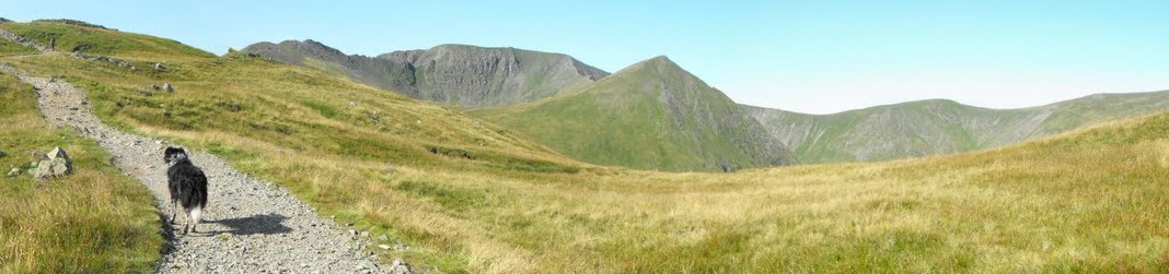
The Coledale Fells with Knott Rigg and Ard Crag looking quite easy from here.

starting the climb up Knott Rigg looking back to Robinson and the road

Knott Rigg summit

from Ard Crags summit looking back towards Buttermere

now descending Aikin Knott.  It's a really nice run along the ridge but it gets steep here and care is required.  The green track I would take is in the centre of this picture.  Catbells (and my car) are ahead across the valley with the blue of Derwent Water just visible between Catbells on the right and the flank of Rowling End on the left.

on the flat(ish) looking back

I think that's Robinson on the far left above the gate, Hindscarth and then Ard Crags.  This is looking back from Little Town, home of Mrs Tiggy-Winkle.

Sunday, November 10, 2013

Great Gable Remembrance Day 2013

nearing the summit - hazy

We had a combination of a walk, remembrance service and a fell run today.  I was hoping to take Kirk Fell head on and over to Great Gable but we thought it might be tight with time so we headed up Great Gable via the Gable Beck route from Wasdale.  There were loads of people heading up, as we got higher, we could see a crowd coming over from Green Gable.  The snow was fairly low down but not very thick and didn't really affect the going.  We took our time getting up, not wanting to be at the top too soon and standing around getting cold but also because we were stuck behind other people.

a bit of cloud over Great Gable but doesn't look like too much snow from here

plenty of people heading up

looking back down to Beckhead.  Still lots of people = botlenecks ahead

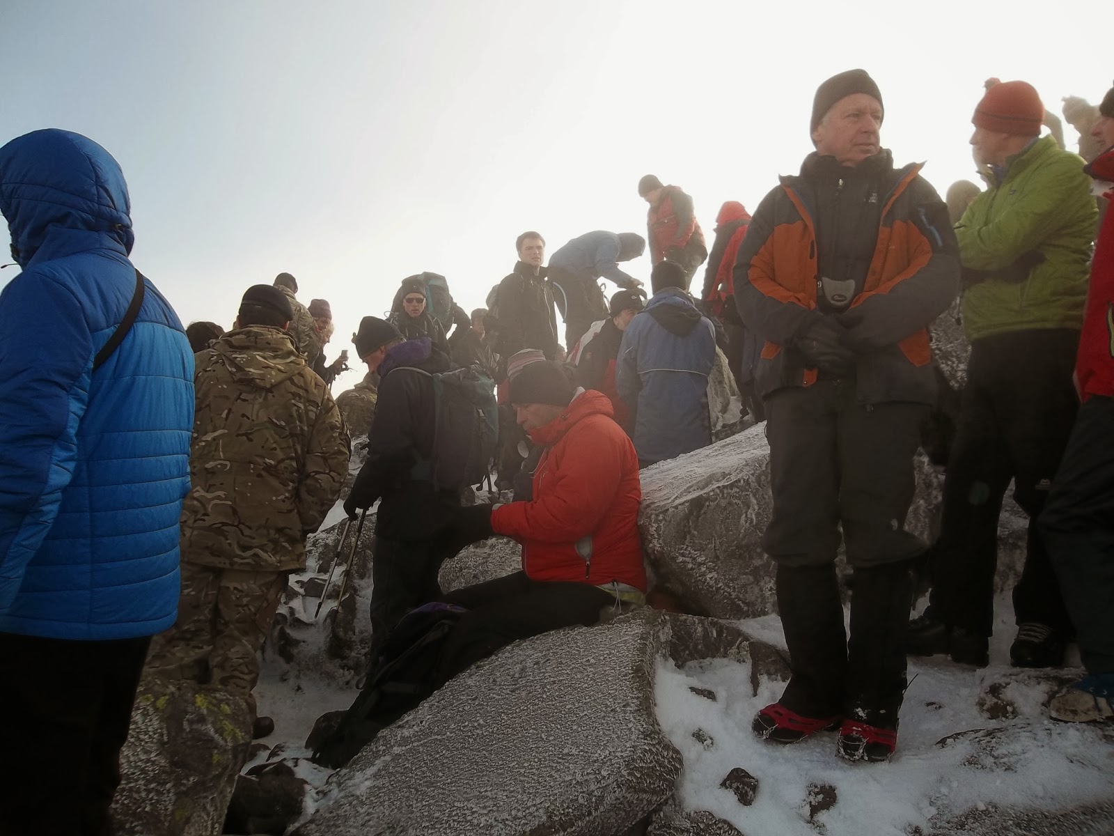
still misty as we reached the top

At the top, I borrowed Jonathan's phone as it takes panoramic pictures.  I took a few and then walked around the summit a few times taking pictures.  It really would have been a good idea to decide on a place to meet after the ceremony as there were probably a few hundred people there.

I bumped into Tania who oversees the Fix the Fells project and also Billy, a mate I have been on a walk with.

After a bit of wandering around, Paul and Jonathan were about ten feet away from me and we got the map and compass out and plotted our way off the summit.  Standing around had made me a bit cold but not too bad really.

We headed down the way we came up and took the Boat How path along the side of Kirk Fell.  We then climbed up to Black Sail Pass and on to Pillar.

Once over Pillar, we headed down to Wind Gap and ran down the scree to the bottom of the valley, eventually picking up the Black Sail Pass path back to Wasdale Head.


looking down Ennerdale
little Brocken Spectre in the middle here

and again

Kirk Fell - one of my favourites

Kirk Fell on the left with the path we are about to take going left to right into Ennerdale valley

now on the path, looking back to Great Gable with Paul and Jonathan catching up


last push to the top! Great Gable on the left
 
top of Pillar - sunshine, no wind and quite a bit of snow

 
Pillar Rock below


looking down from the top of the scree - it was a good half mile or so of carnage! 

looking back up from the bottom

9.5 miles - 4200ft of elevation

Saturday, November 2, 2013

Around Rannerdale

looking back down the valley
Not much to report today.  I had planned to run along the southern edge of Coledale, climbing up to Whiteless Pike and then along to Causey Pike, meeting Jonathan at the bottom of Barrow scree for a run over Barrow, Outerside and then up to Grasmoor with a choice of descents back to the car.  However, the journey up the valley next to Rannerdale Knotts was proof enough that I wasn't going to venture onto the tops today.  I got blown around enough here so I headed up and over the col and then back down to Buttermere and back along the road.