 |
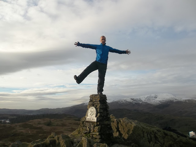
| definitely Black Crag |
Today's walking was wonderful, with my recent knee woes, I'm more thankful than ever that I can still get out for a decent walk (even if it is with old-man sticks). The map reading...not so great.
 |
| lovely picture (spoiled by Jonathan) |
The anticipation started on Wednesday. You see, Wednesday is about the earliest that you can have any sort of accurate weather prediction. The prediction for Saturday was clear and cold - ideal!
With the snow that has been laid on the fells over the last week or so, talk was of an epic, crampon wearing hike. When it came down to it though, the weather prediction wasn't so great. Starting off fine and clear with cloud and rain rolling in for the afternoon.
I decided to try to 'mop up' some Wainwrights, targeting Black Crag and Holme Fell. These are smaller fells, so ideal to do when I'm not at my full fitness. They are also some of the furthest away and, to be completely honest, some of the ones that I am least excited about. I'm not sure which Wainwright fell I am going to leave until the end but I want it to be somewhere a bit special. So it would have been good to get these two out of the way.
Here is the route, just short of 9 miles.
We parked at the small National Trust car park (membership paid for itself ten times over) and took the path through the woods, past the waterfall to Tarn Hows. The tarn was frozen. The ice was thin, we tested it with stones.
 |
| Tarn Hows |
Tarn Hows is a beautiful area. Good for a family walk. The National Trust even have a mobility scooter that they lend out to visitors.
Tarn Hows would also be really good for trail running or mountain biking. The paths are well kept and wide with not too many hills.
I saw this money tree on the side of the path. There are approximately half a million visitors to Tarn Hows every year and this is reflected in the number of coins hammered into the tree.
From the end of the tarn, we headed through the Iron Keld plantation. Up to the right on the hill, we saw that we were being watched:
The deer hung around, allowing me to take a few pictures.
It was all going so well at this point. I was looking out for a particular point in a wall that was my cue to head up to the top. I was aware that there were two tops to Black Crag and so I wanted to make sure that we visited both as I could not remember which was the Wainwright summit.
We could see one of the summit cairns so we headed straight for it.It was a bit of a trudge over the open fell, although the ground was partially frozen so this took off the worst of the bog.
 |
| Snowy Langdale Pikes |
 |
| Black Crag summit trig point |
 |
| Jonathan on Black Crag |
 |
| me - being cool |
 |
| and again |
 |
| south cairn |
Looking over, we could see the other cairn on Black Crag. As I mentioned, I was not sure which was the Wainwright top so we visited both. We got a bit, er...creative with this cairn. It wasn't the type you can stand on top of so we decided to do handstands against it.
After finding an easy way down from here, we headed over to Hodge Close, the Scariest Cave in Britain! It was certainly quite scary standing at the top looking over the edge. It's a long way down. People have jumped from here into the water. My friend damaged his back when he fainted on the way down and landed wrong. Hodge Close is popular with divers, there is a system of flooded mine shafts, although people have died while diving here, usually due to getting lost and running out of air. It's also popular with climbers and abseilers.
 |
| long way down |
My map reading skills seemed to leave me after we left Hodge Close. We took a wrong turn in the woods, heading north when we should have gone south.
This meant a bit of a trudge through heather and across bogland.
We also met this funny looking cow and a few of its mates.
Eventually, with the help of my gps and some serious consideration of the map, we saw what we thought was the summit of Holme Fell. Yep, what we thought was the summit. Did you spot the slight issue in the map above? Here is a close up:
That black circle with a W in it is the Wainwright summit of Holme Fell.
That red line is the route I took.
Ideally, the two would meet at some point!
That red line is the route I took.
Ideally, the two would meet at some point!
The 'summit' we were at was actually Ivy Crag. Very pretty and all but not a Wainwright.
Now this did happen to me once before with High Street. High Street summit cairn is slightly off the path, near the wall. The first time we went along the old Roman road, we were running through a hail storm so just assumed we had passed over High Street.
I've since been back to High Street and I am going to have to go back to Holme Fell at some point. Ah well, life could throw me worse challenges than having to go fell walking again!
 |
| duh! - Ivy Crag |


No comments:
Post a Comment