Sunday, March 10, 2013

20 miles along the Cumbria Way

Skiddaw House - conditions worsening at 14 miles in

I had a few different plans for today including some higher fell challenges.  My fell run from last weekend taught me how much more difficult a bit of elevation can make a run.  With this lesson in mind, and the relatively flat course of the upcoming Rivington 26.2 coming up in two weeks, I decided on a flatter course.  The weather also had a say, bitterly cold with widespread snow was the forecast - perhaps not the weather for higher lakeland adventures.

I had my heart set on the first section of the Allerdale Ramble, a 54 mile route starting from Seathwaite.  We could meet in Cocermouth, drive one car to Seathwaite and then run the 23 or so miles along the Allerdale Ramble to the other car.  I did my planning on Memory Map Software using an OS 1:50k map of the Lake District which has the Allerdale Ramble clearly marked (you can see it in the maps below).

In the morning, when I went to work out which maps I would need to take with me, I saw that the Allerdale Ramble is not marked on the OS 1:25k Explorer Maps or the Harvey 1:25k Superwalker, or the Harvey 1:40k BMC Lake District Map.  Obviously, not having the route on the map makes it more difficult to follow.  I could have made up a route card with the main locations to run through but I really did fancy just following a premarked route.  So instead, I decided we would run a section of the Cumbria Way, which is a 70 mile route starting in Ulverston, but that today we would start in Rosthwaite.  The Cumbria Way is marked on maps and is also well signposted along the way.  Here is our route:


this way
I had measured the car park at Overwater to be 20 miles from Rosthwaite so we headed there first, leaving Jonathan's car there.  We spent a few minutes working out some logistics, yes, I need to take all my running gear but my clean clothes should stay at Overwater, along with my wallet (although I'll take my bank card and a fiver, just in case of emergencies).

It seemed like a very long drive to Rosthwaite.  Our route was not that different to the route we would be running, the main part being that we would run around the back of Skiddaw.  We had the same logistical considerations on leaving my car at Rosthwaite, with one minor error (more on that later).  Then we headed off towards the river and alongside it to Grange.

heading off from Rosthwaite

back on the road at High Close
The first few miles were the familiar route along past Castle Crag.  Once in the woods, you pass Milican Dalton's Cave and then carry on through the woods, past the camp site and out onto the road at Grange.  We probably didn't take the official route here as we found ourselves hopping over a fence at a large property called High Close before running along the driveway to go through the very grand gate onto the road.

We ran down the road for a bit before joining the track across to the Derwentwater shoreline path at Great Bay.  We spotted reassuring yellow arrows at various points along the way.

The path along through Manesty Park and then Brandlehow Park is a really beautiful section of the Lake District.  It is very popular and probably underrated for this reason.  A run around Derwentwater is a lovely route to take after work in the summer.  I think it's about 7 miles.  Today, we would follow the path along the west shore for about 3 miles.

heading towards Derwentwater


The route continues through Portinscale, then Keswick, joining up briefly with Bob Graham territory and the climb up Spooney Green Lane towards the Ormathwaite car park.

heading towards Keswick with a moody Cat Bells visible across the playing fields

climbing up to Latrigg and Cat Bells visible again, now across Derwentwater

Ormathwaite car park and a reassuring yellow arrow on the post

snow starting on the run around Lonscale Fell
Once out of Keswick, the hardest section of the run today started.  We would run around the back of Lonscale Fell and Skiddaw to Skiddaw House and then on to Peter House Farm.  The weather was changing for the worse at this point (although it had never been particularly good).  

As we split from the main track up Skiddaw, turning east, there we were hit by snow and an icy wind.  Further around Lonscale Fell, where we had a bit of shelter, the snow was heavier but at least we were out of the wind.  The track gets a lot rougher here but at this point the major climbing is done and the route is a lot more runnable.

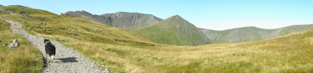
high level track towards Skiddaw House
 
arms length portrait - brrr!

Skiddaw House

fork in the road
The track splits after Skiddaw House.  One arm goes up to High Pike, the fell that we spectacularly failed to find the last time we were in this area.  Luckily, we did not want to go that way.  Our plan was to continue straight ahead on the main track towards Dash Falls.

The track is very clear at this point, impossible to stray off so we carried on along the few miles to Dash Falls.  From this point, the track goes mostly downhill to Peter House Farm.

I enjoyed this section.  We were at about the sixteen mile mark but I felt like I could have carried on for a lot longer.

Despite being very clear about where we were, it's always a relief when a familiar area comes into view.  I recognised the Dash Fall area from previous runs and walks.  I also remembered the downhill bit.  The last mile or so towards Peter House Farm is on smooth tarmac and felt really nice.  Jonathan was breaking new ground in his distance totals.

climbing up, Skiddaw House is back in the trees

frozen gate at Dash Falls.  Dead Crags ahead

the track down from Dash Falls, Jonathan on the right (catching up)

At Peter House Farm, we had the option of running up the road or continuing on across fields, through a wooded area, around a tarn and then up the road.  We were at about 17.5 miles so we chose the latter option to make it up to the 20 mile mark.

The route finding got a bit more difficult from here on in but we managed ok.  The climb up through the woods was not expected but this did lead to a nice gentle run though fields on the other side.

We got back onto the road at Orthwaite and then ran along the road for the last half mile or so to Jonathan's car.  It was at this point that Jonathan realised that he had left his keys in my car, which was 20 miles away in Rosthwaite!  A quick check of the map showed that the village of Uldale was about a mile up the road so we headed here, calling Jonathan's dad on the way to bring spare car keys.  In Uldale, we found a nice tea room (fully licensed) with a wood burning stove.

We set about redressing the calorie deficit.


Here's the run on Strava:

Monday, March 4, 2013

Grasmere to Dockray via Glenridding

top of Sheffield Pike looking towards Catstyecam centre right
Every time I go out in the Lake District I learn something new.  One of the things I learnt today is that one 16 miles can be very different to another.  Last week, we did a 16 mile recce run of the Rivington 26.2 trail marathon course.  I felt fresh at the end, as if I could have carried on for a while.  Today, I was spent at 16 miles.  To be honest, I was a bit done in at 14.

Objectives for the day were to get a good distance in, I was hoping for 20 miles but underestimated the elevations involved.  I also wanted to do a linear run, joining up parts of the Lake District usually visited separately, and as the event centre for the GL3D has just been published, it wouldn't do any harm to run through here to help familiarise myself with the area a bit.  Of course, if I managed to cover a few Wainwrights, all the better.

Here is the route with elevation.

16.3 miles, approx 7000 ft of elevation, approx 5 hours moving (add another hour for not moving).


Being on a fixed timescale, the idea being to meet Jonathan on the way to Penrith to head to the new Go Outdoors store and stock up on kit for the GL3D, I set off from Grasmere at about 8am.  I ran back up the road before heading along a wide track after passing the Travellers Rest.  I picked out the flank of Seat Sandal, my aim being to continue heading up to the summit cairns.  There was a bit of snow on the way but nothing needing more grip than my Speedcross 2s were giving me.

As with most initial climbs, I found it tough going.  I usually try to pick out routes that get the climbing over at the start and then involve a horseshoe or gradual undulation.  Today I had deliberately tried to make things a bit harder.

back towards Grasmere from the initial climb
My route planning was loose but it was clear that I would be grounding out at Glenridding before climbing again.

It was a relief to get to the top of Seat Sandal.  From this point, the snow was thicker.  It was mostly hard frozen snow so the spikes were put on.

The last time over Seat Sandal, I had come in the opposite direction.  What I remember to be a very difficult climb up turned out to be a pleasant ski down.  The snow was just soft enough to use my heel as a brake but hard enough to slide down sideways.  The hard packed snow had smoothed out the rough surface and, by snaking left and right as if I was skiing, I was soon down at Hause Gap.

from Seat Sandal towards Coniston fells.

and over and up to Fairfield and St Sunday Crag (the direction of travel)

over to Dollywagon Pike and Helvellyn

Frozen Grisedale Tarn from the ski down Seat Sandal

The snow continued to be thick up the climb to Fairfield.  Near to the top I stopped to apply a plaster to a hotspot on my heel.  I definitely caught this one in time, preventing any permanent damage.  As I climbed Fairfield, the snow became more widespread and at one point, I caught myself wandering towards a cornice, not exactly snowblind but perhaps snowshortsighted as the edge blended into the rest of the whiteness.

Up on the top of Fairfield was the time that it looked most likely to snow so I didn't hang around and continued my skiing tactics down to Cofa Pike.  Again, the last time I did this stretch was in the opposite direction (a different day to the last Seat Sandal ascent).  I remember the climb up Cofa Pike and then on up to Fairfield being a major undertaking but today it seemed really easy.

cornice on the way up to Fairfield.  Cofa Pike visible in the middle before St Sunday Crag

from the top of Fairfield.  I think that is Coniston Water on the left
Ullswater and low cloud from Fairfield
Cofa Pike

from Cofa Pike looking back up to Fairfield

The run up to St Sunday Crag was full of false summits.  The snow was thinning out again now and, once I was at the top, I took my spikes off and proceeded to slip and slide down the other side.

up to St Sunday Crag

down to Ulswater

looking back to Fairfield

There's a nice run down this side of St Sunday Crag.  I ended up running around the peak of Birks and down Thornhow End to the road leading to Grisedale Bridge.  I ran the mile or so to Glenridding where I sat on the bench outside the visitors centre, studying my map, considering my time limitations and making alterations to my route.  After a while I realised that people were looking at me in a funny way because blood was gushing down my shin.  I had slipped onto my knee on the descent from St Sunday Crag and had not realised that, under all the mud, I had cut my knee.  After a quick rinse in the toilet sink, I headed for the Greenside Mine road, heading off before the row of cottages for a steep climb up to Glenridding Dodd.

Glenridding.  Time for a wash!  Glenridding Dodd ahead.

climbing up, looking back

I don't know if I chose the best route up Glenridding Dodd.  It was hard going, lots of scree and gorse.  It didn't take too long though.  Once at the top, brilliant views of Ullswater open up.

Glenridding Dodd cairn looking towards Ullswater

From Glenridding Dodd, there is a clear path down to intersecting walls.  Some close map study will identify a way through without having to climb walls.  From there, I found my way up, joining with the main path as the gradient eases off towards the summit.

Sheffield Pike summit looking up to Green Side

Stone marking the boundary between the Marshall and Howard estates.  I don't know what the ER is for.
Date on the stone is 1830.

climbing up to Green Side, looking back to Sheffield Pike.  High St in the distance

at Green Side, cloud rolling over the Dodds

looking down to Rush Gill, Dowthwaite Head
From Green Side, the temptation was to carry on to Stybarrow Dodd and then along the Dodds.  However, Hart Side was an unclaimed Wainwright (and there was a lot of cloud over the Dodds) so I headed sharp right, north east over to Hart Side.

From the top of Hart Side, I plotted a way over to Rush Gill which I followed to Dowthwaitehead.

I ran down the bank to cross at an old weir, checking out an old building that had a big padlock on the front door but no window.  It looked like it might be used for a makeshift bothy.

Following the path down, it passed through Dowthwaithead Farm, the recently announced first base of the GL3D for 2013.  I wondered if we would be heading back up this way in May.

weir and crossing point

Dowthwaitehead Farm

From the farm, I followed the road, taking a slight wrong turn at Crookwath before heading back to the road and on the one mile downhill run to Dockray.

I had no phone signal at this point but arrived just as Jonathan was driving along the road.  I directed him to The Royal where I had a pint, Jonathan an orange juice (sore head).

After a healthy (or not so) dose of ibuprofen, we headed to Go Outdoors to check out the gear we needed for the GL3D.  Looking forward to it.